
Cruising the Antarctic Peninsula
February 2nd, 2026
For the next four days we will be cruising along the Antarctic Peninsula.
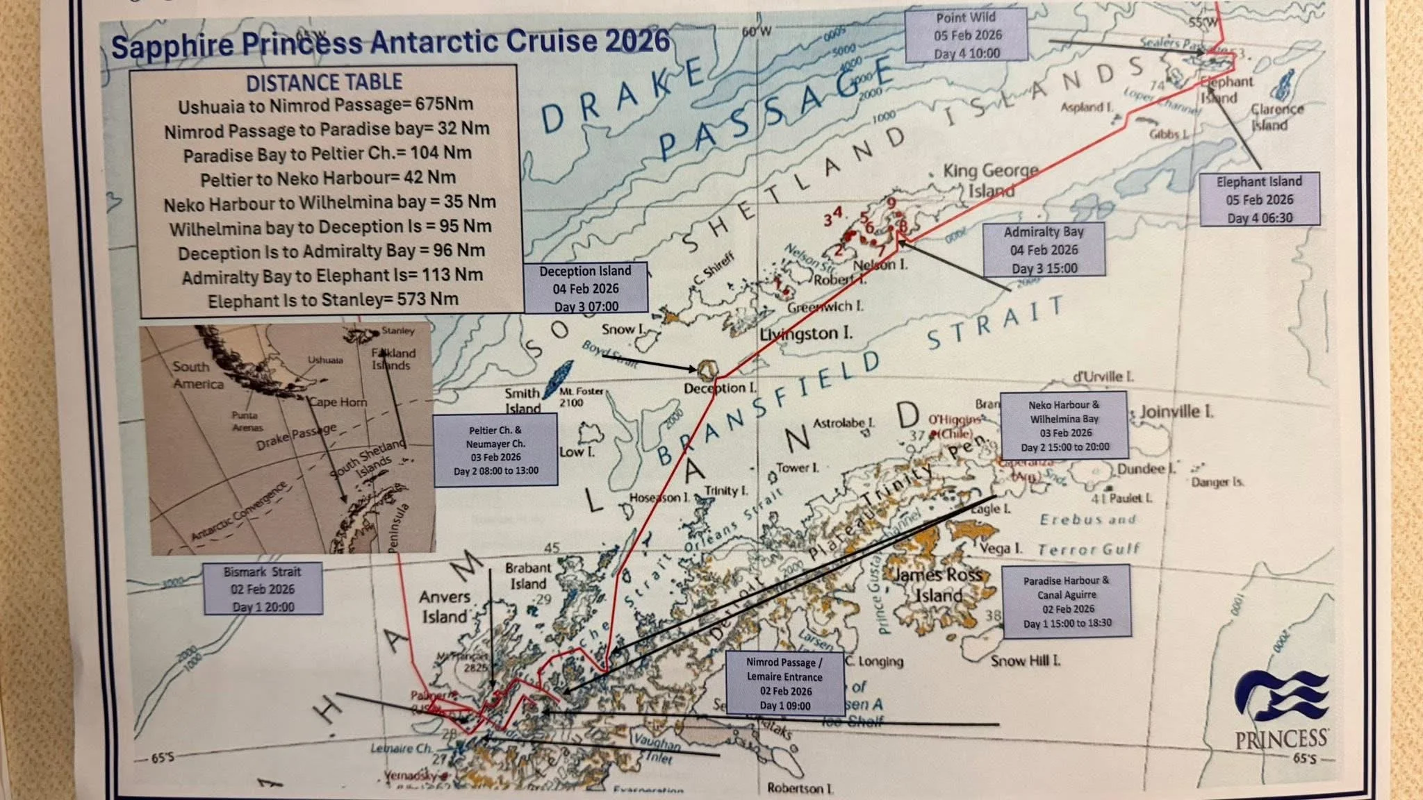
Map of our route.
Day 1 (February 2nd)
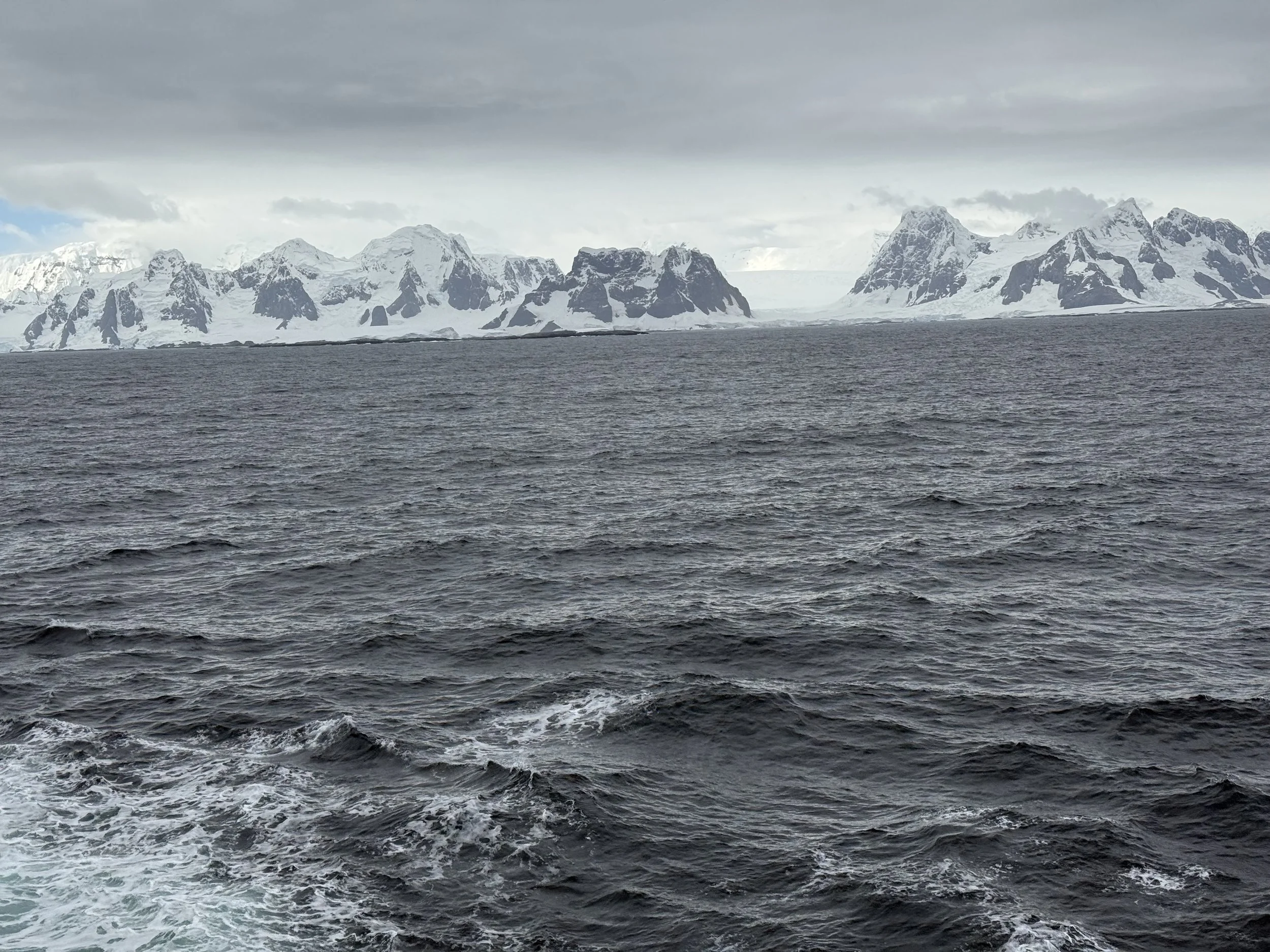
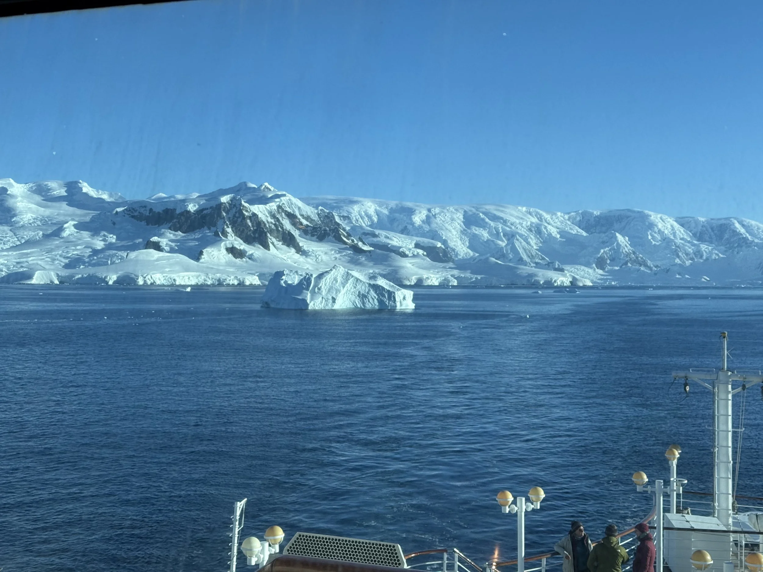
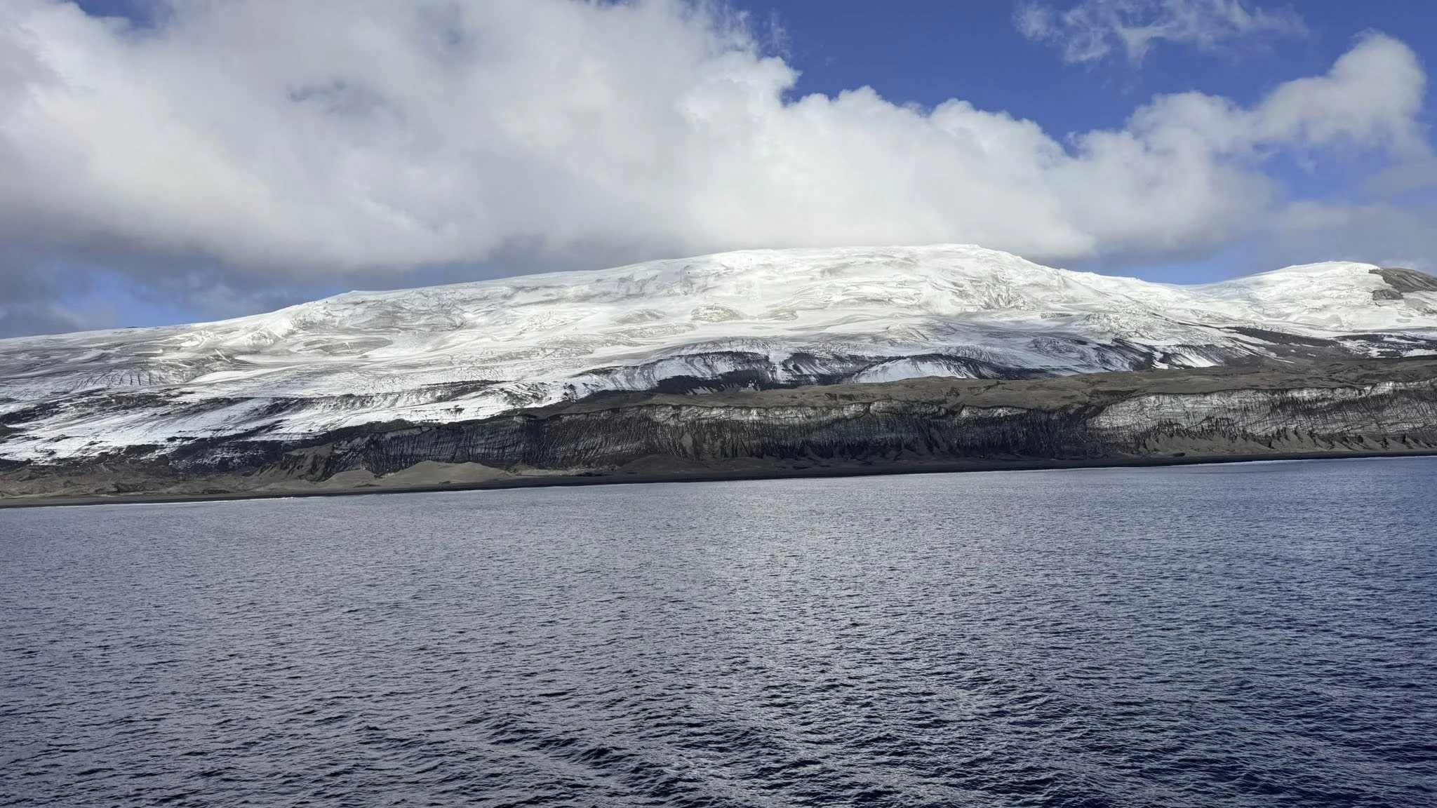
We finished crossing Drake’s Passagen around 10:00am. The waters became calm and we started to see land. This is part of the Antarctic Peninsula. The cruise ship usually does an east to west route starting at Elephant Island to Bismark Strait. Due to the directions of the winds and currents, the captain decided to reverse the route and start at the Bismark Strait.
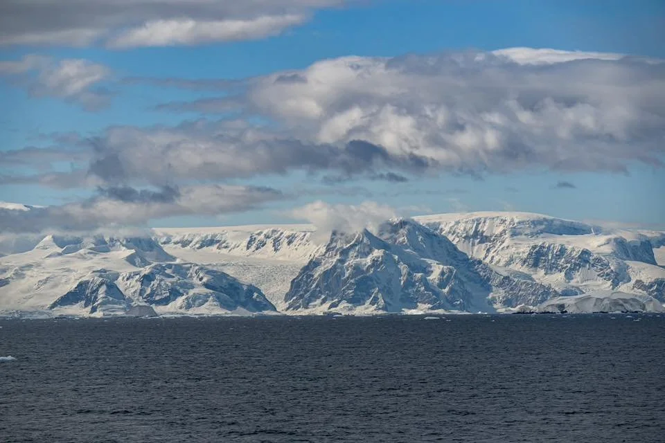
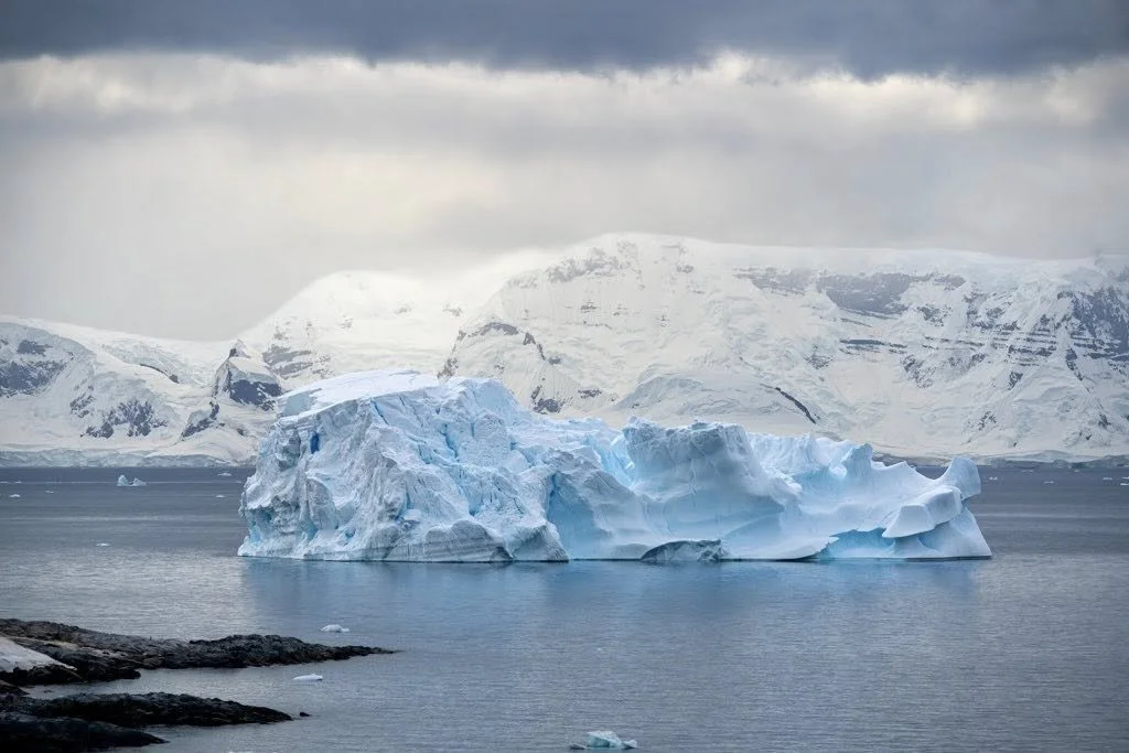
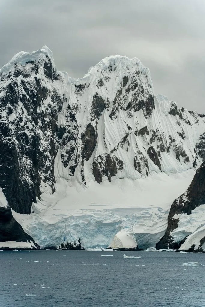
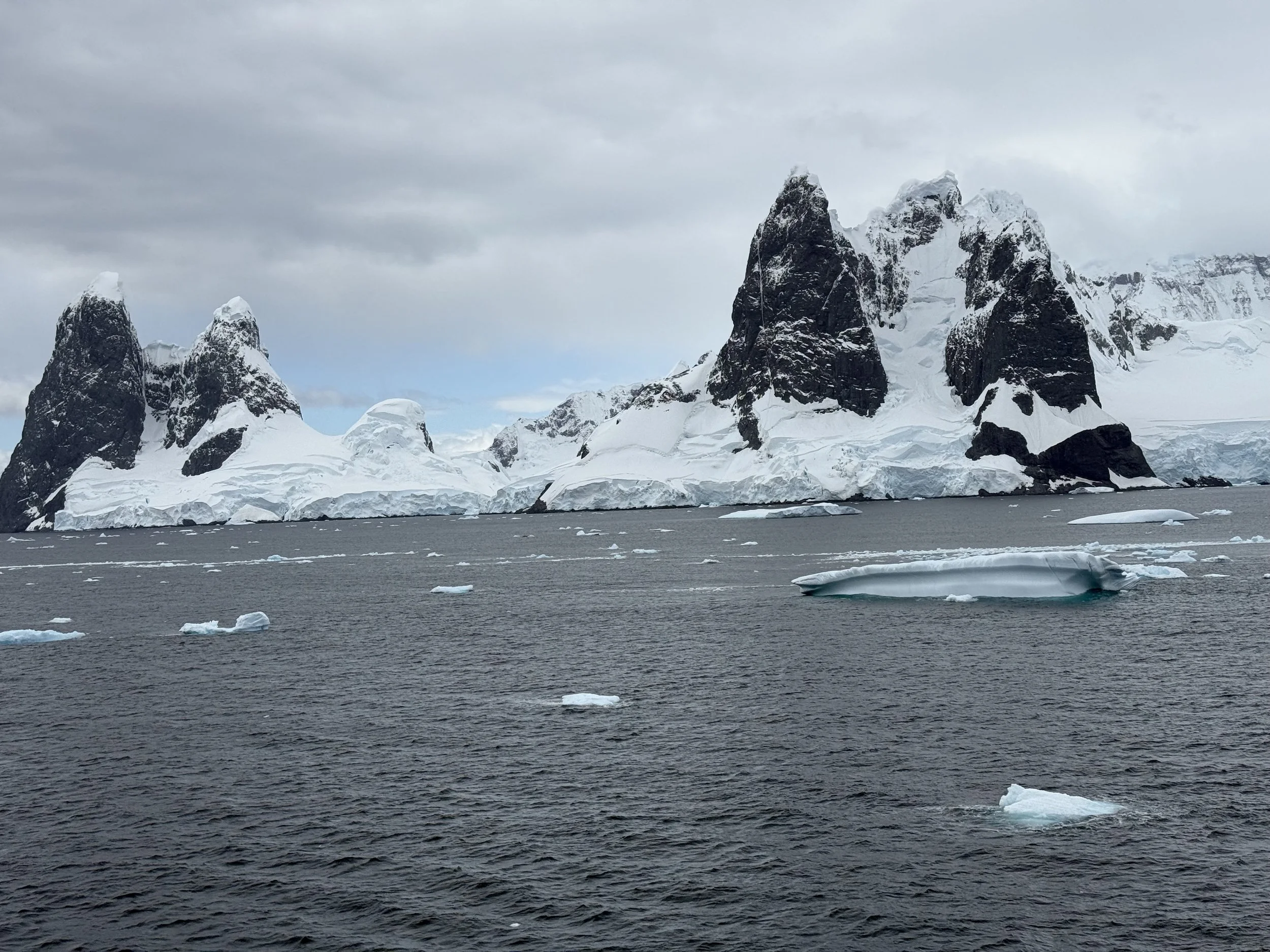
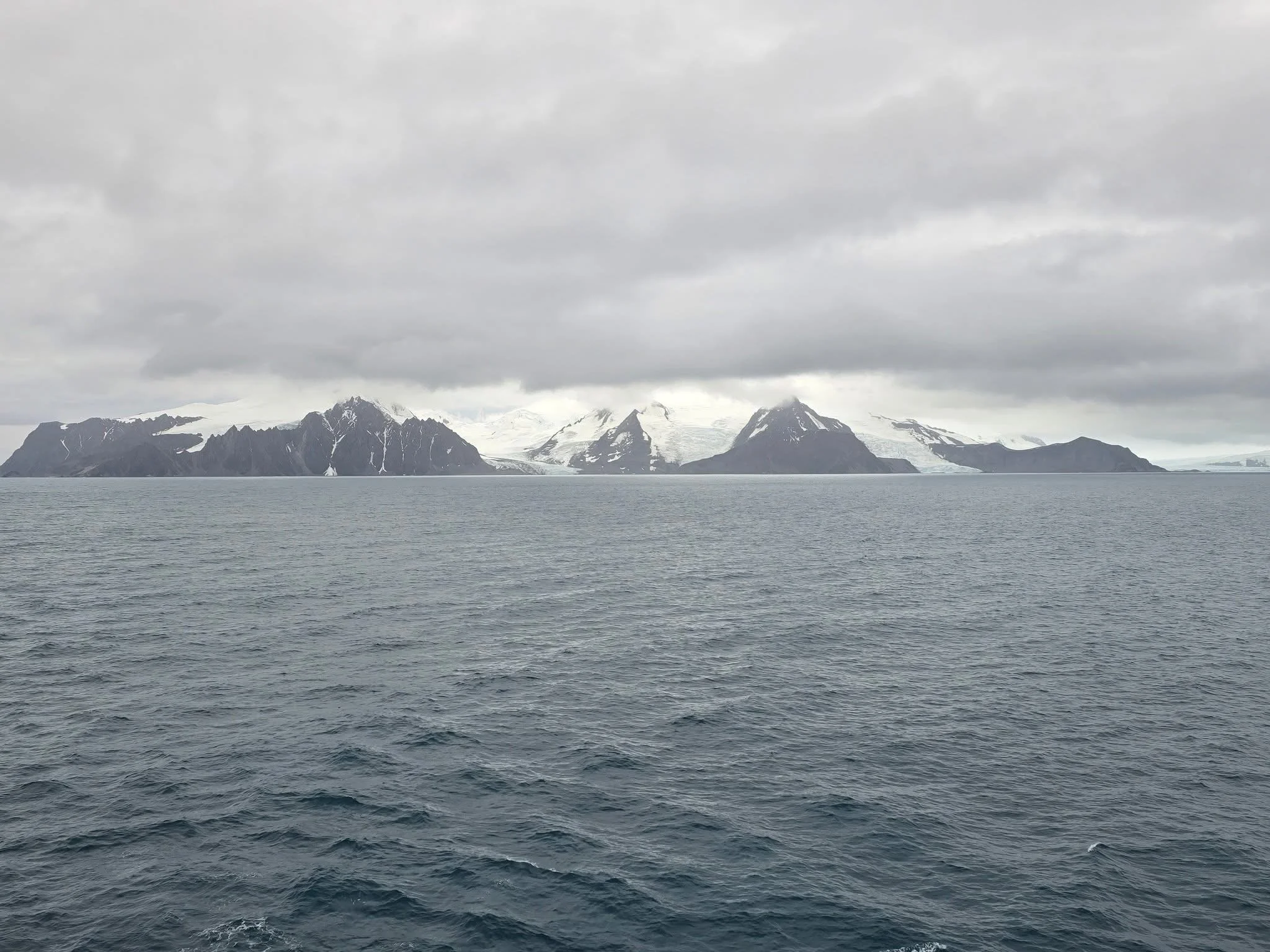
The sky was cloudy, but the landscape was still amazing with mountainous rock formations covered in snow.
Bismark Strait
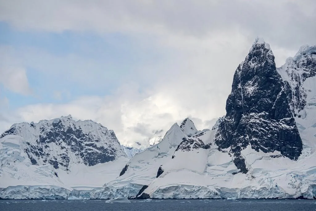
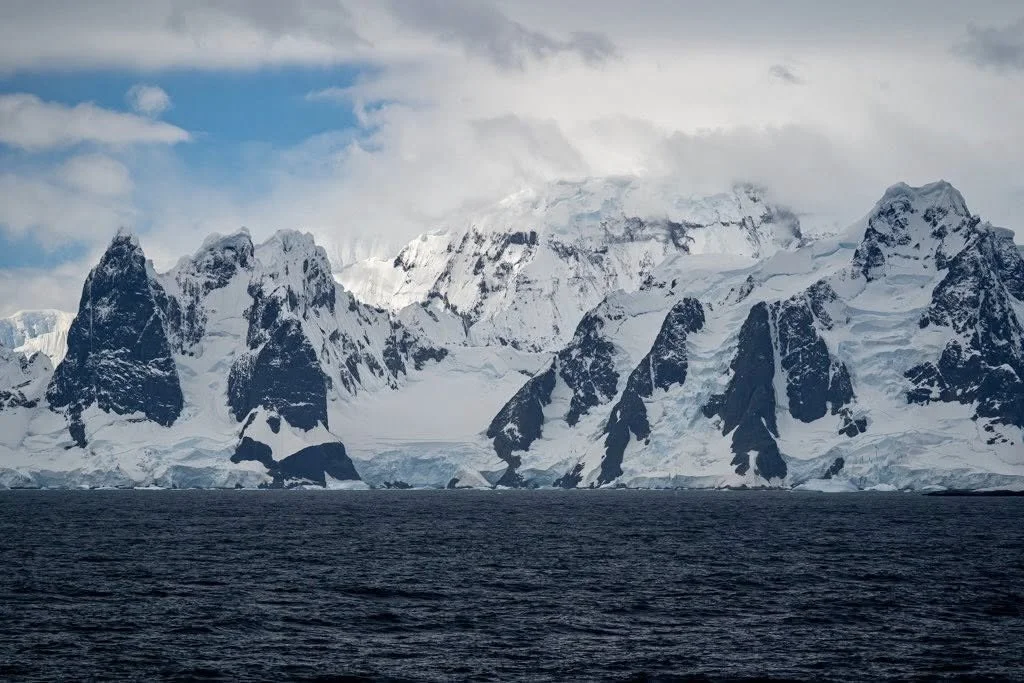
Bismark Strait
The Bismarck Strait is a channel in Antarctica, located between Anvers and Wiencke Islands and the Wilhelm Archipelago, named after German statesman Otto von Bismarck.
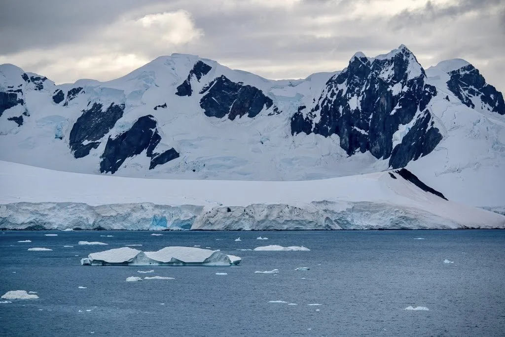
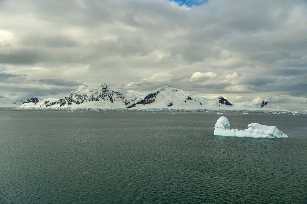
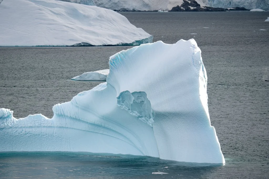
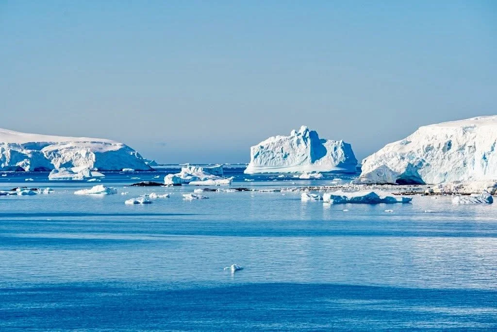
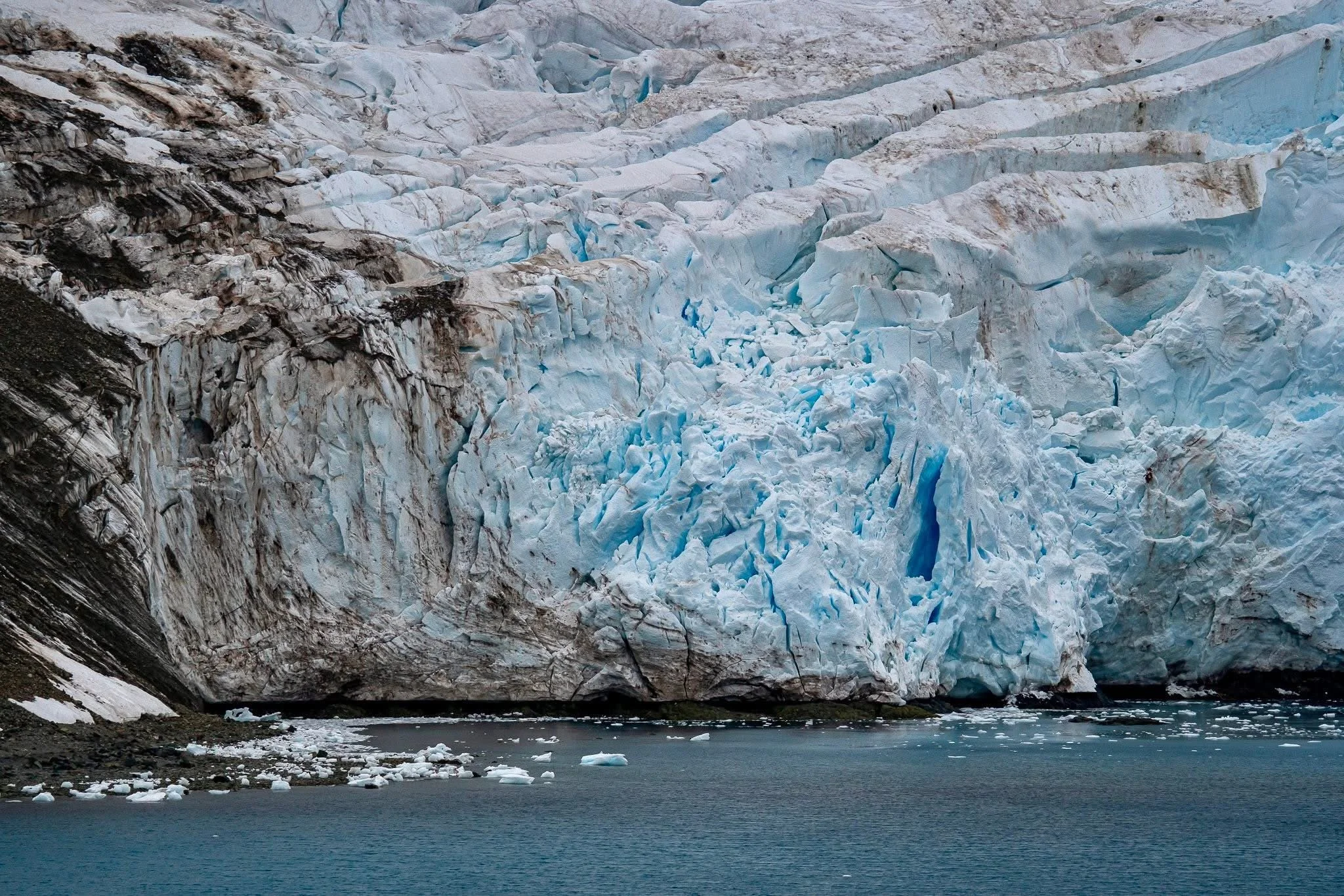
We started to see icebergs and glaciers as we entered. Hopefully we will see some whales soon.
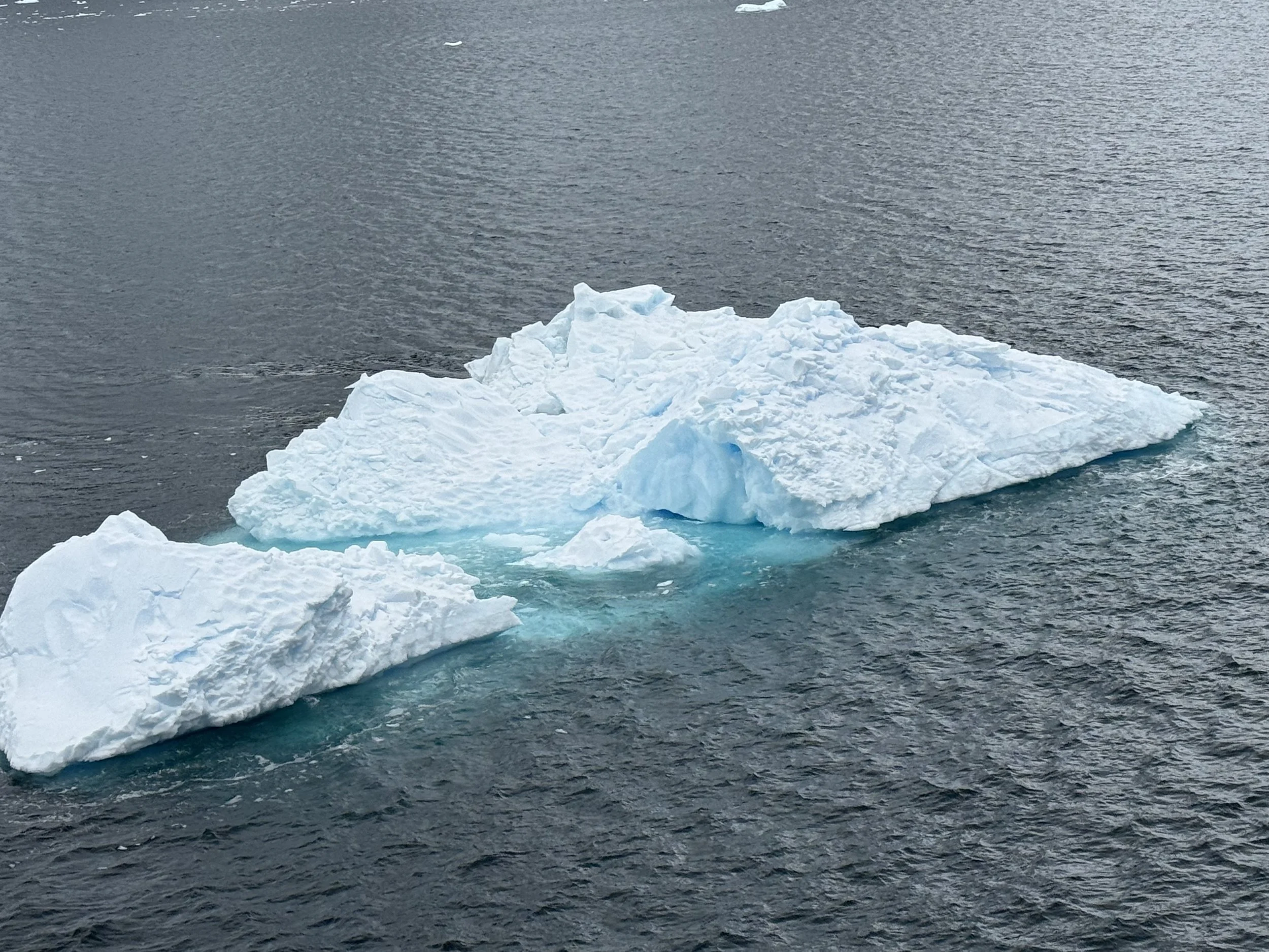
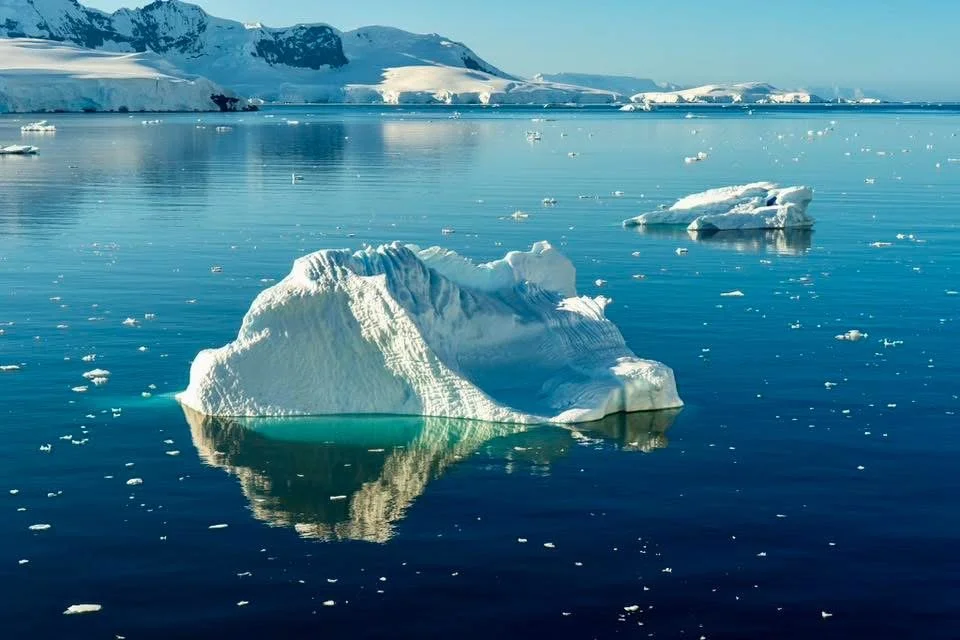
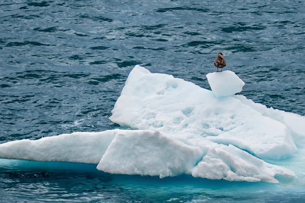
A small iceberg.
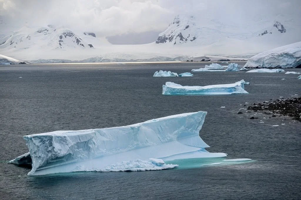
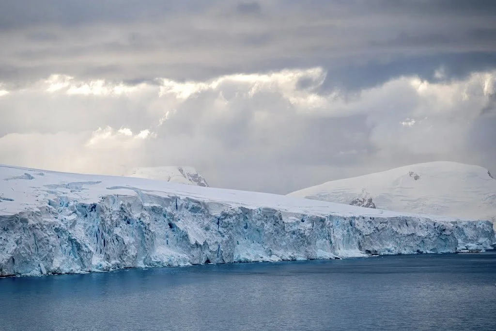
One of many glaciers we saw.
Nimrod Passage & Lemaire Entrance
The Bismark strait took us to the Nimrod Passage.
Nimrod Passage is a narrow marine waterway in Antarctica, running west to east from Bismarck Strait to the northern entrance of Lemaire Channel, situated between the Wauwermans Islands to the north and the Dannebrog Islands to the south in the Wilhelm Archipelago.
The weather was cold, but we were able to dash in and out of our cabin to view as the ship moved on.
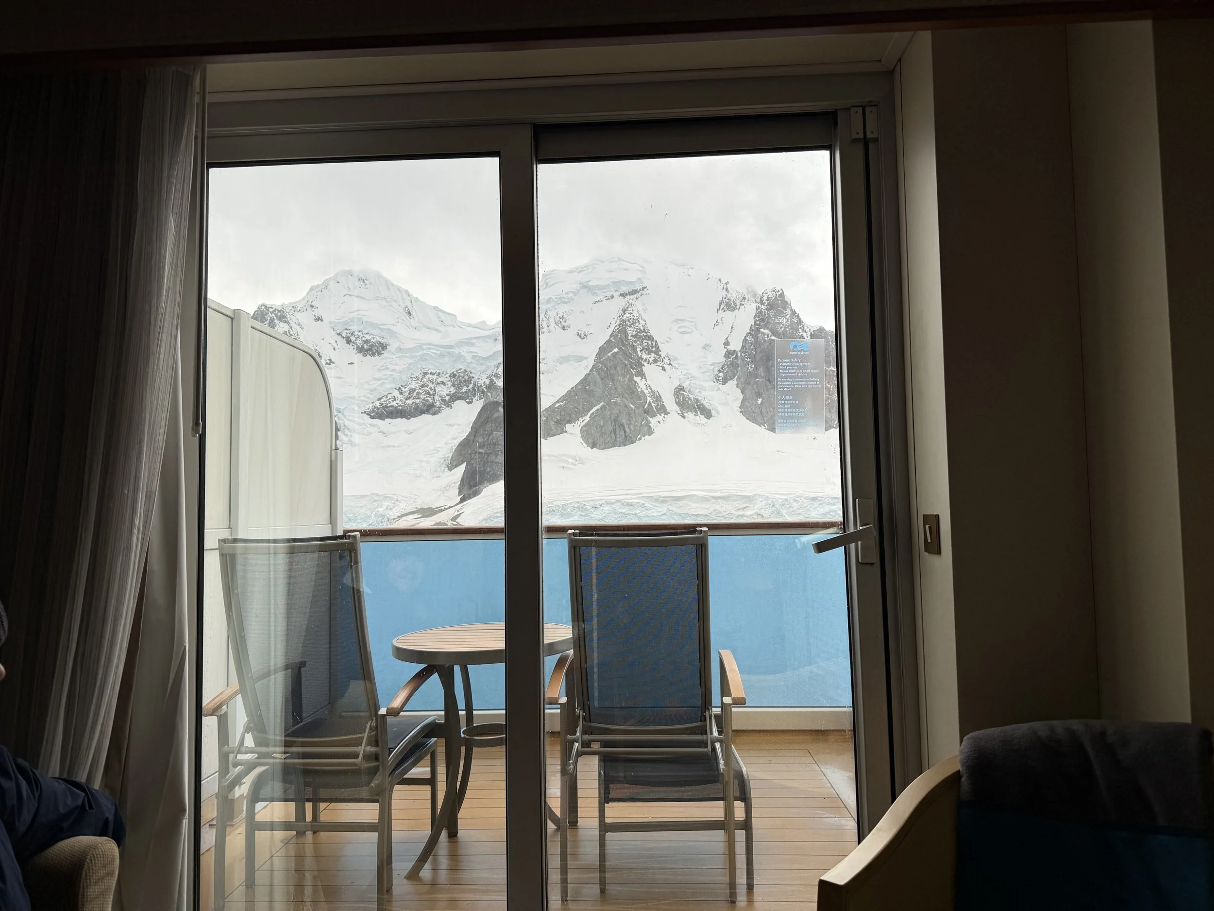
View from our cabin.
There were occasional whale sightings as we went through the passage. The views we had were stunning never the less.
Looking for Whales from our balcony.
Then we came across the Chilean Research Center. There were thousands of penguins surrounding the center. I have been told that the workers there often have to move the penguins out of the way.
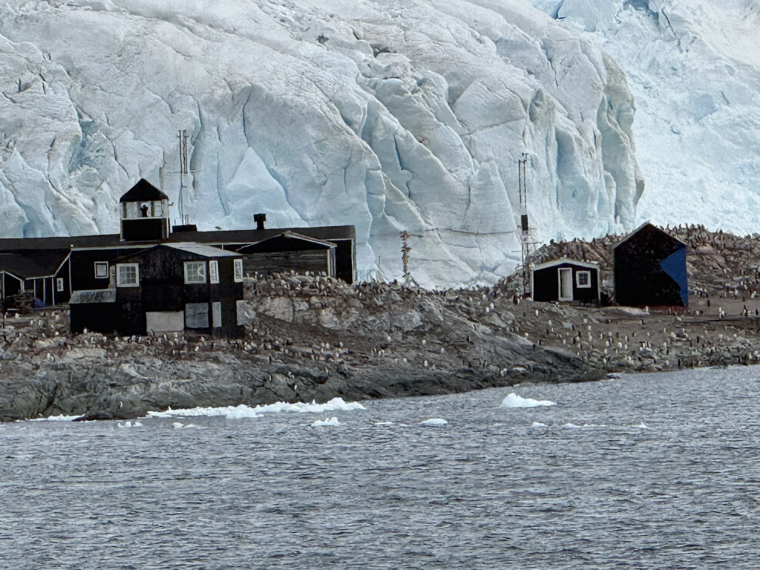
Chilean Research Center.
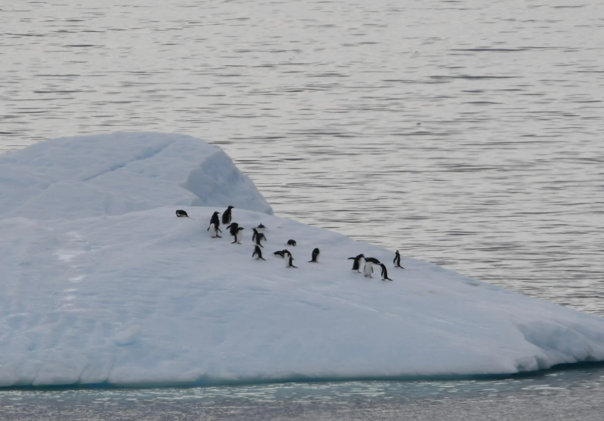
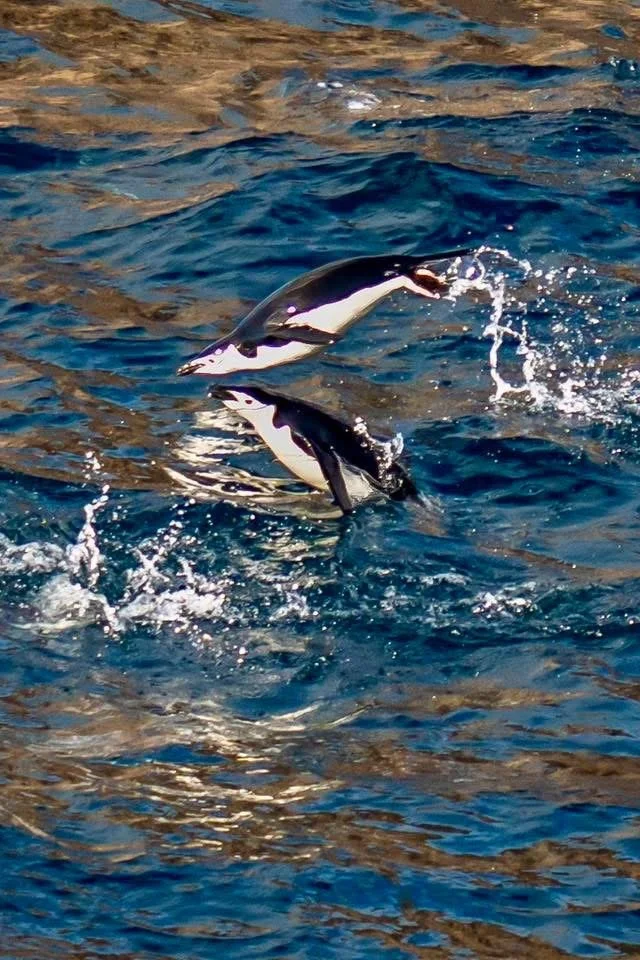
As we continued along the passage, we continued to see penguins. A group of penguins is called a waddle. We saw many waddles of penguins swimming past the ship.
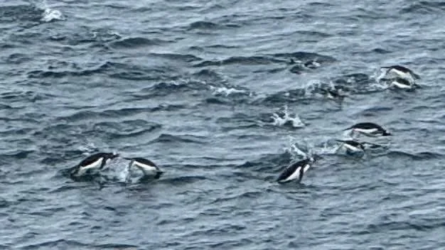
A waddle of penguins swimming past.
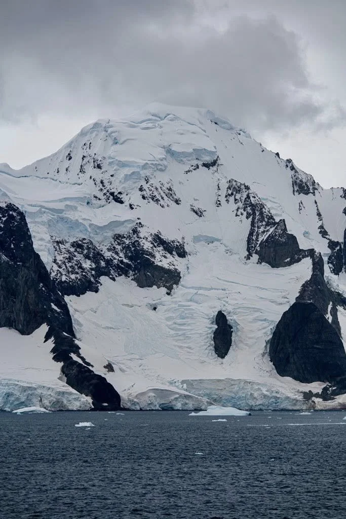
More amazing views.
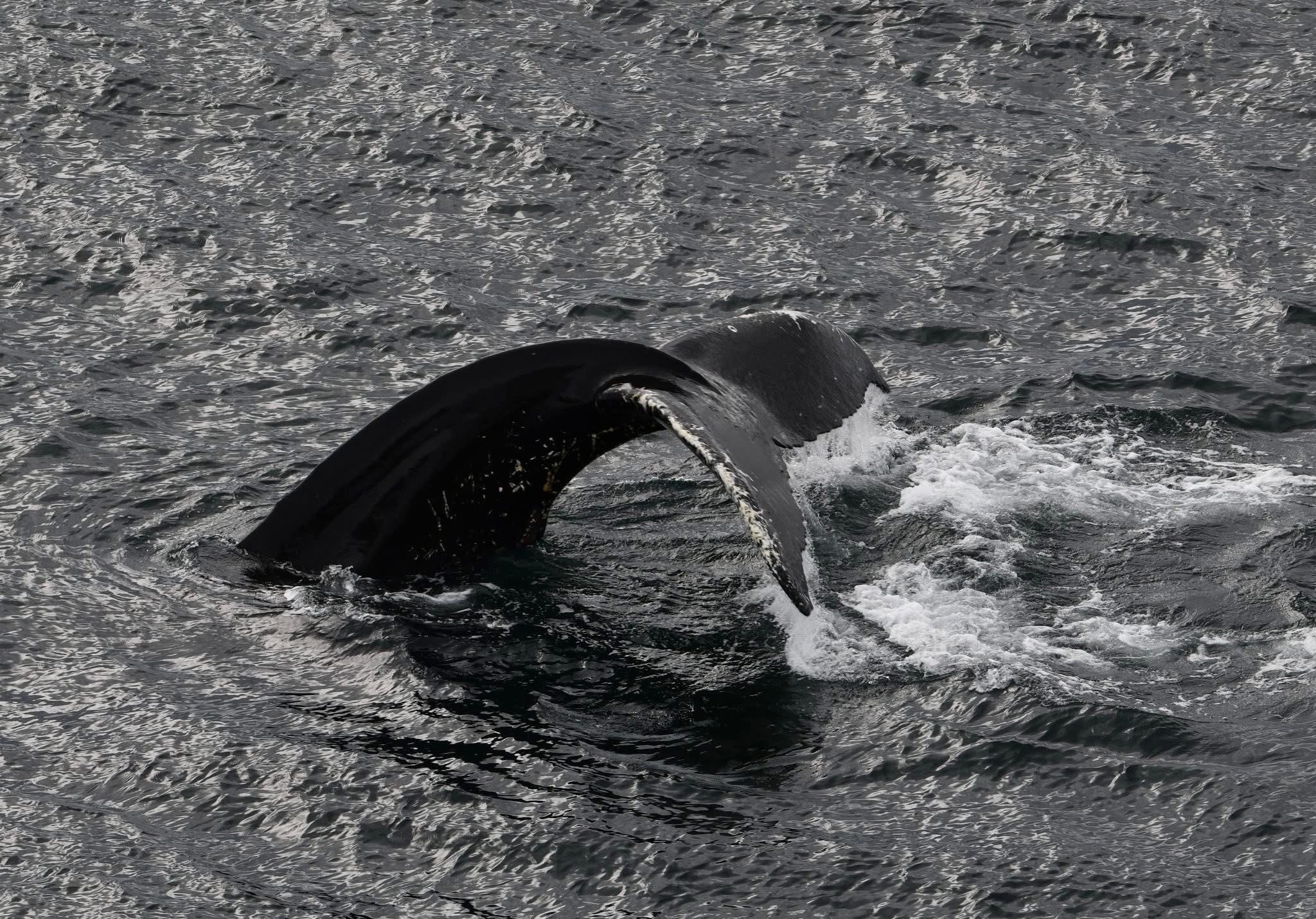
Many whales were sighted as well. Hard to get a good photo. Luckily I made a friend of someone with a good camera!
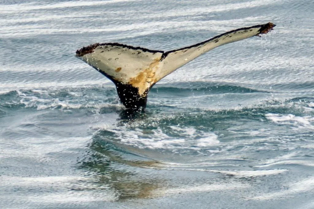
One of the 5 humpback whales we saw today.
The captain took us into Lamaire Channel and we were able to get to the 65th parallel. Apparently this is unusual for ships our size. This took us to the Antarctic Circle where you get 24 hours of sunlight at winter solice. We will get some darkness, but it will most likely be twilight at night and not total darkness.
Paradise Harbor & Canal Aguirre
Next we headed to Paradise Harbour. This is a sheltered area where ships would stop for the night. But is also had amazing glaciers and abundant wildlife. We saw gentoo penguins and whales as well as seals.
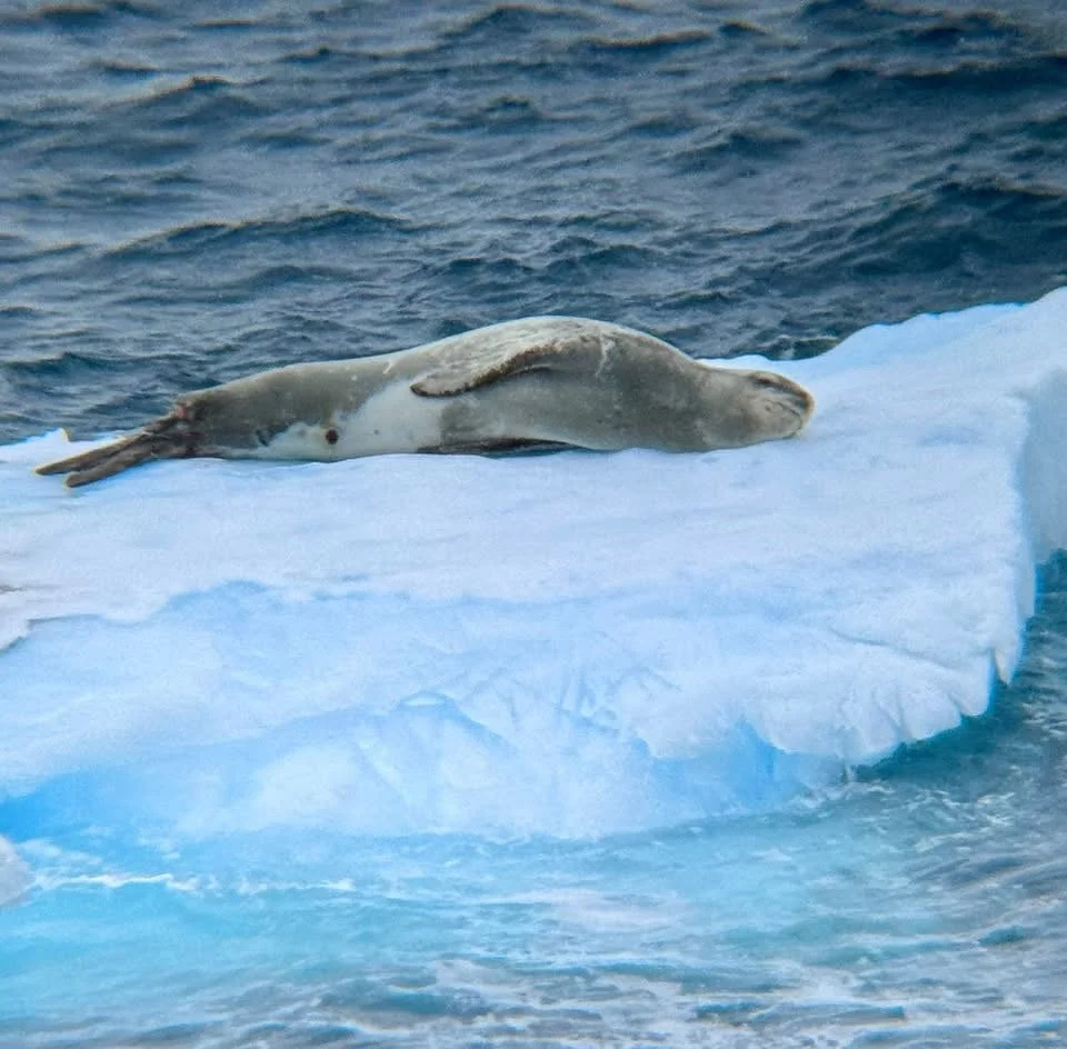
Seal napping on an iceberg.
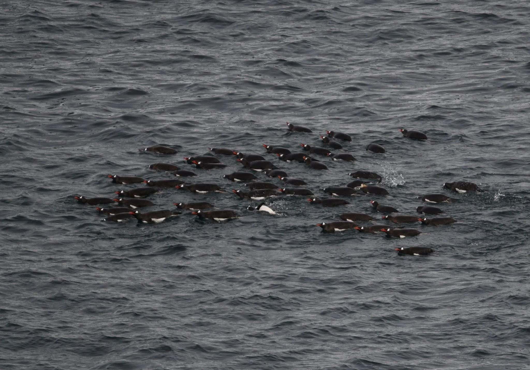
A group of penguins is called a Waddle. We had many waddles of penguins go past us today.
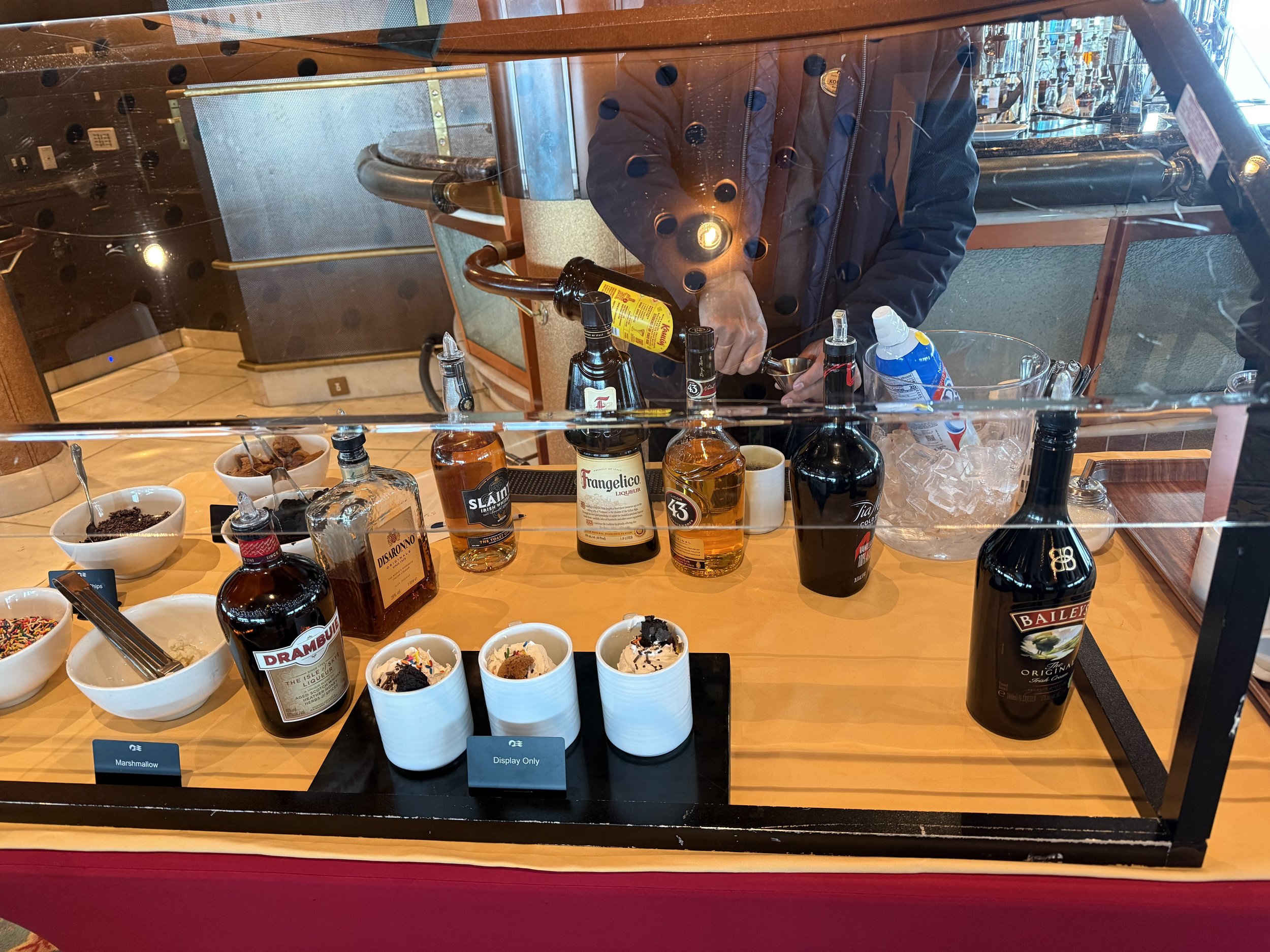
Hot Chocolate Station.
The ship has hot chocolate stations located all over the ship. In addition to hot chocolate, they offer Baileys, Kahlúa and other options to add to your hot chocolate.
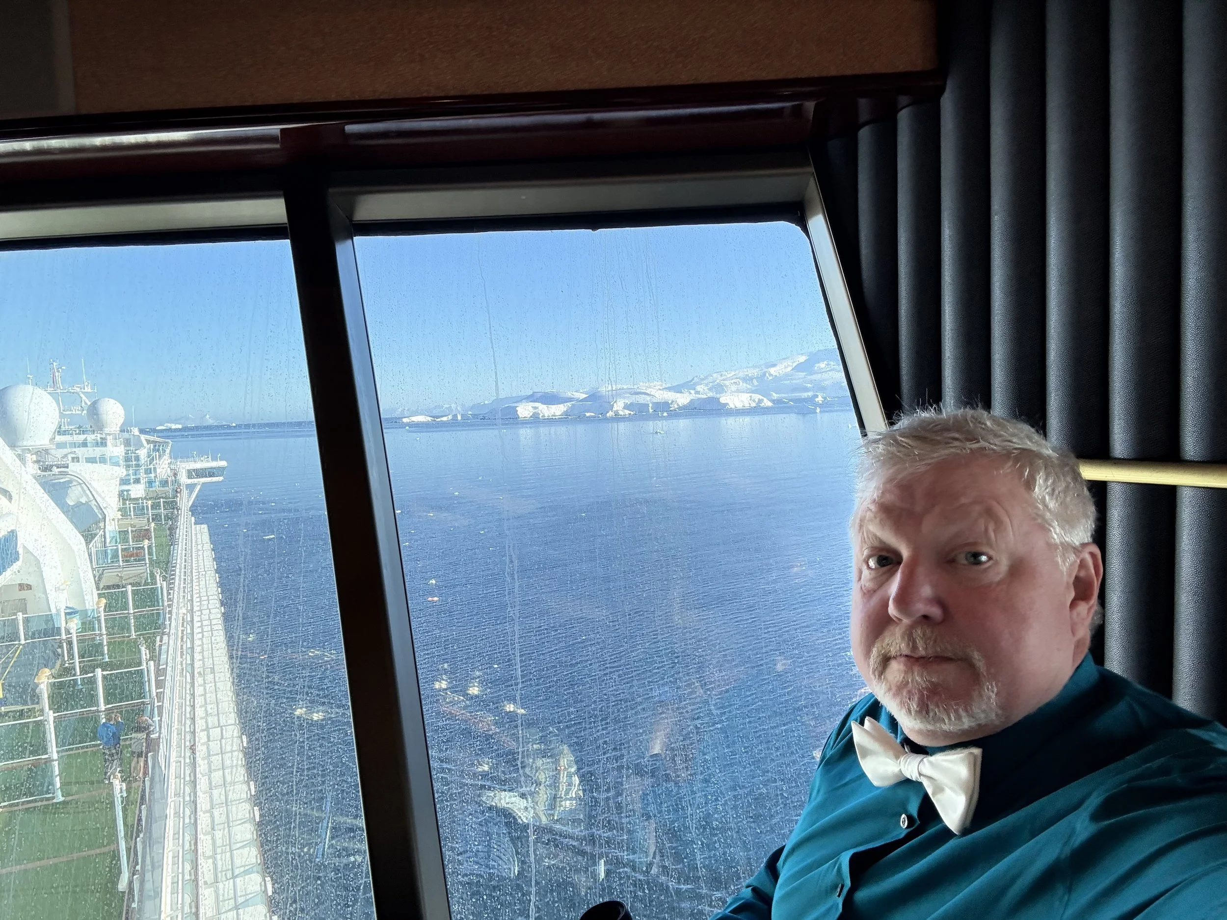
The sky started to clear a bit and really made the snow capped mountains pop. We headed up to the Skywalker Lounge on the 18th floor of the ship. It gave us some great views.
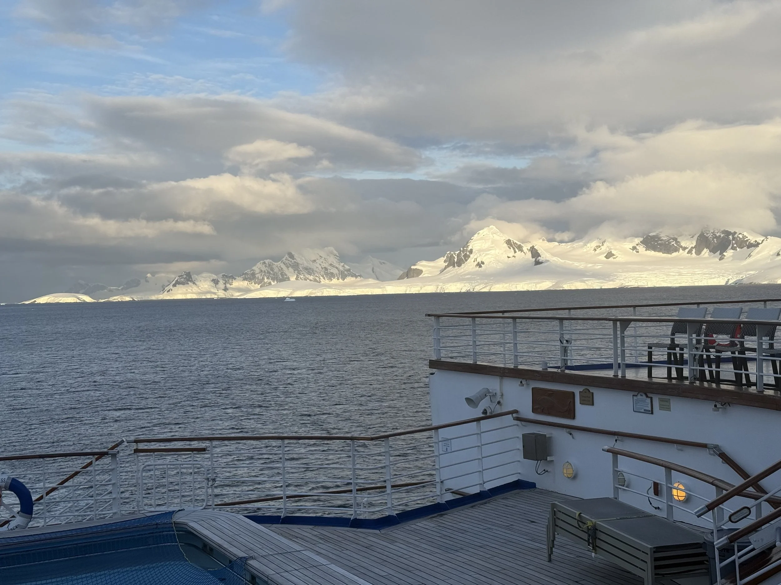
View from back deck of ship
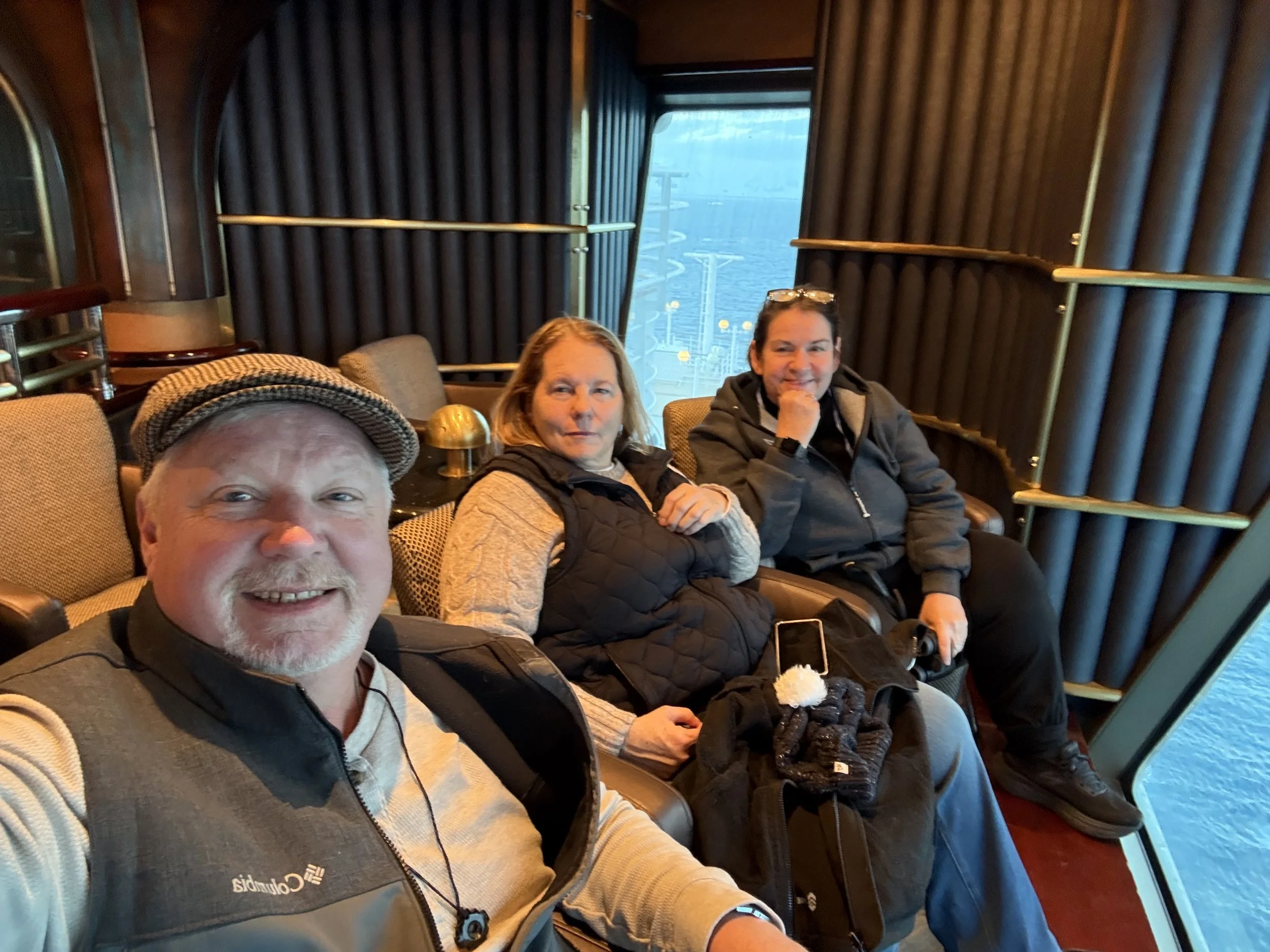
Sitting in the Skywalker Lounge that hangs over the water.
Day 2 (February 3rd)
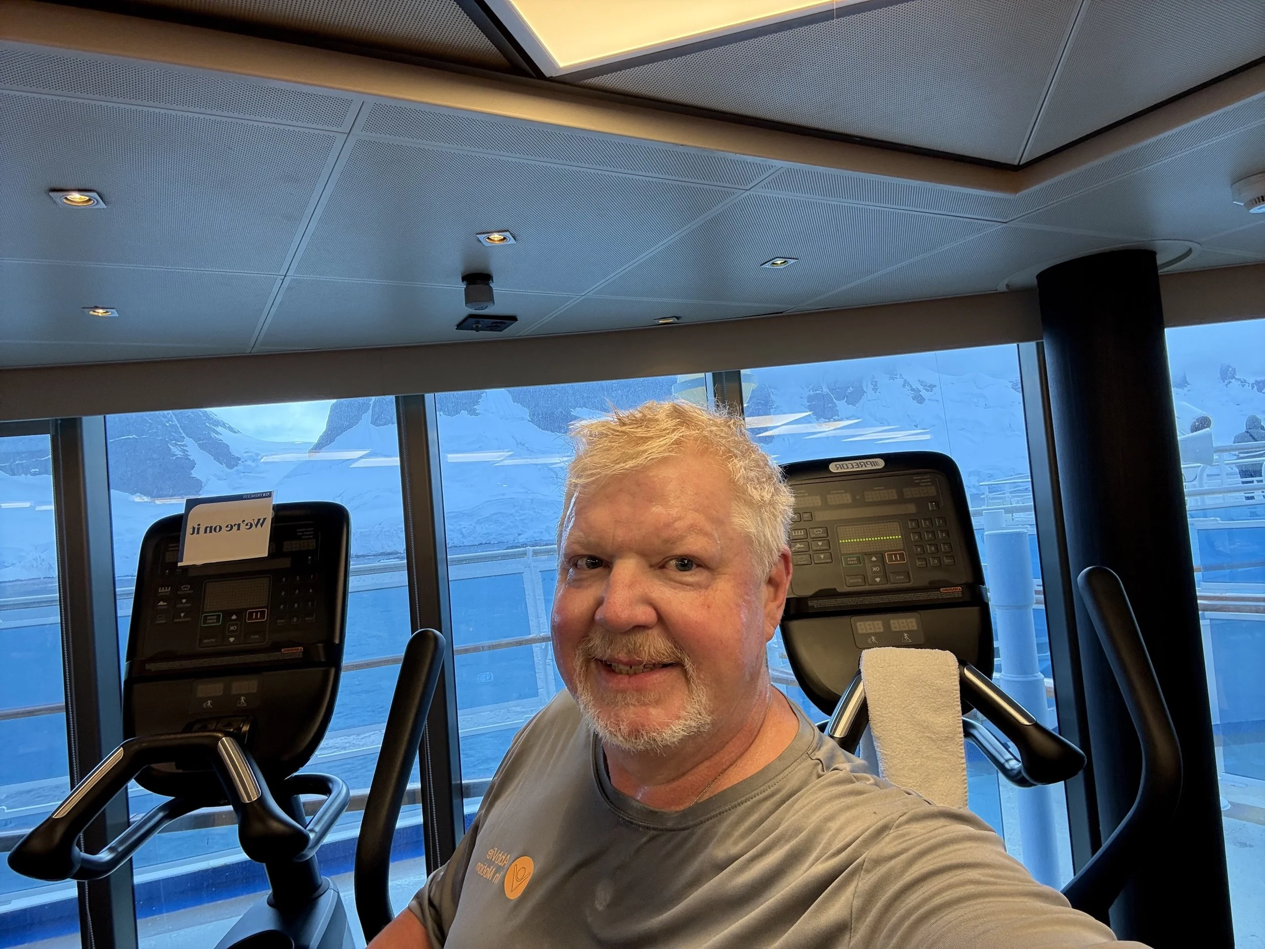
Today I got up early and went to the gym on the ship. All the treadmills and bikes face out over the front the ship. It was nice having a great view while I exercised. I had to stop now and again to watch whales pass by.
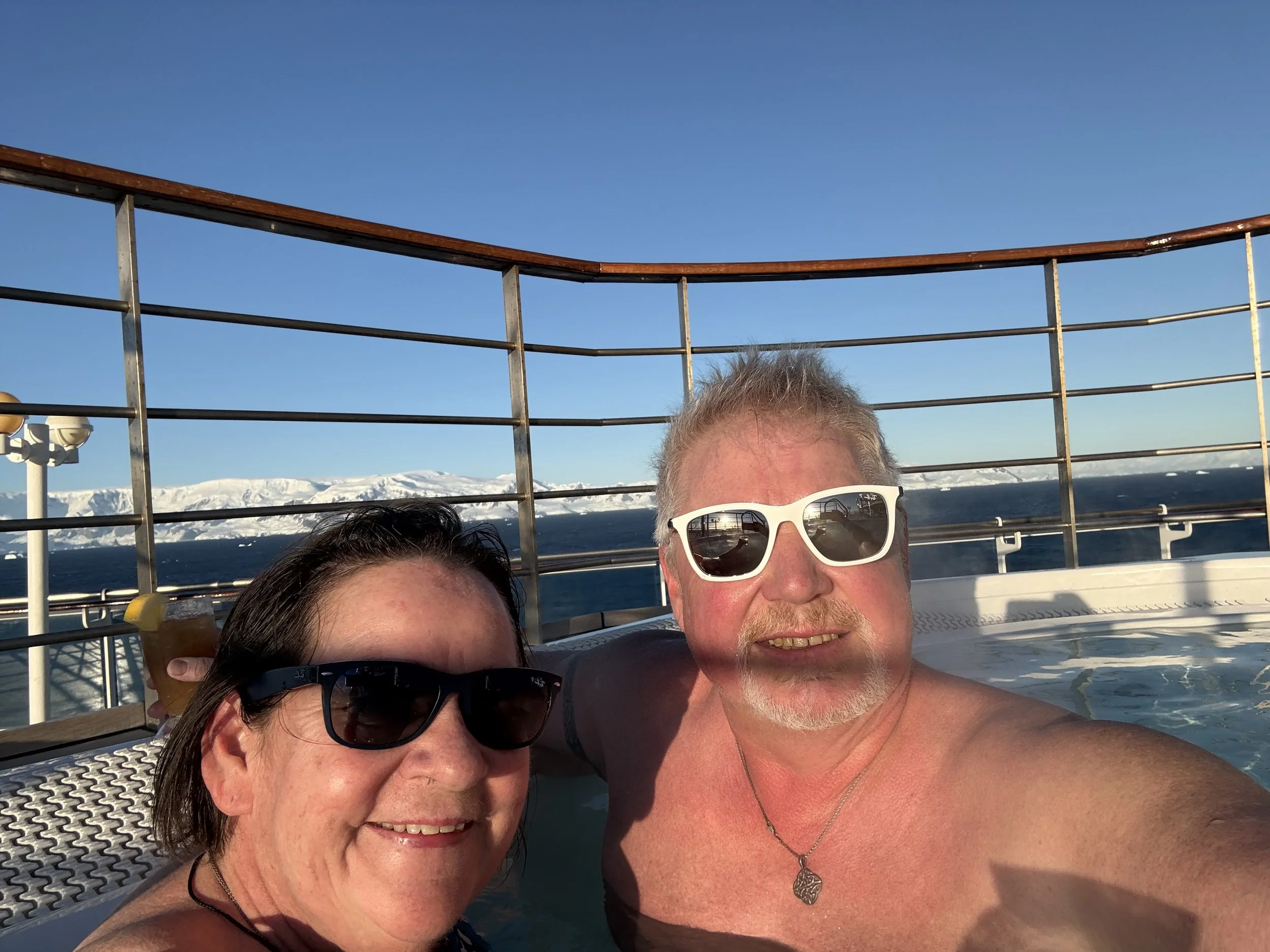
Then I went to the back of the ship to resume whale watching from the hot tub!
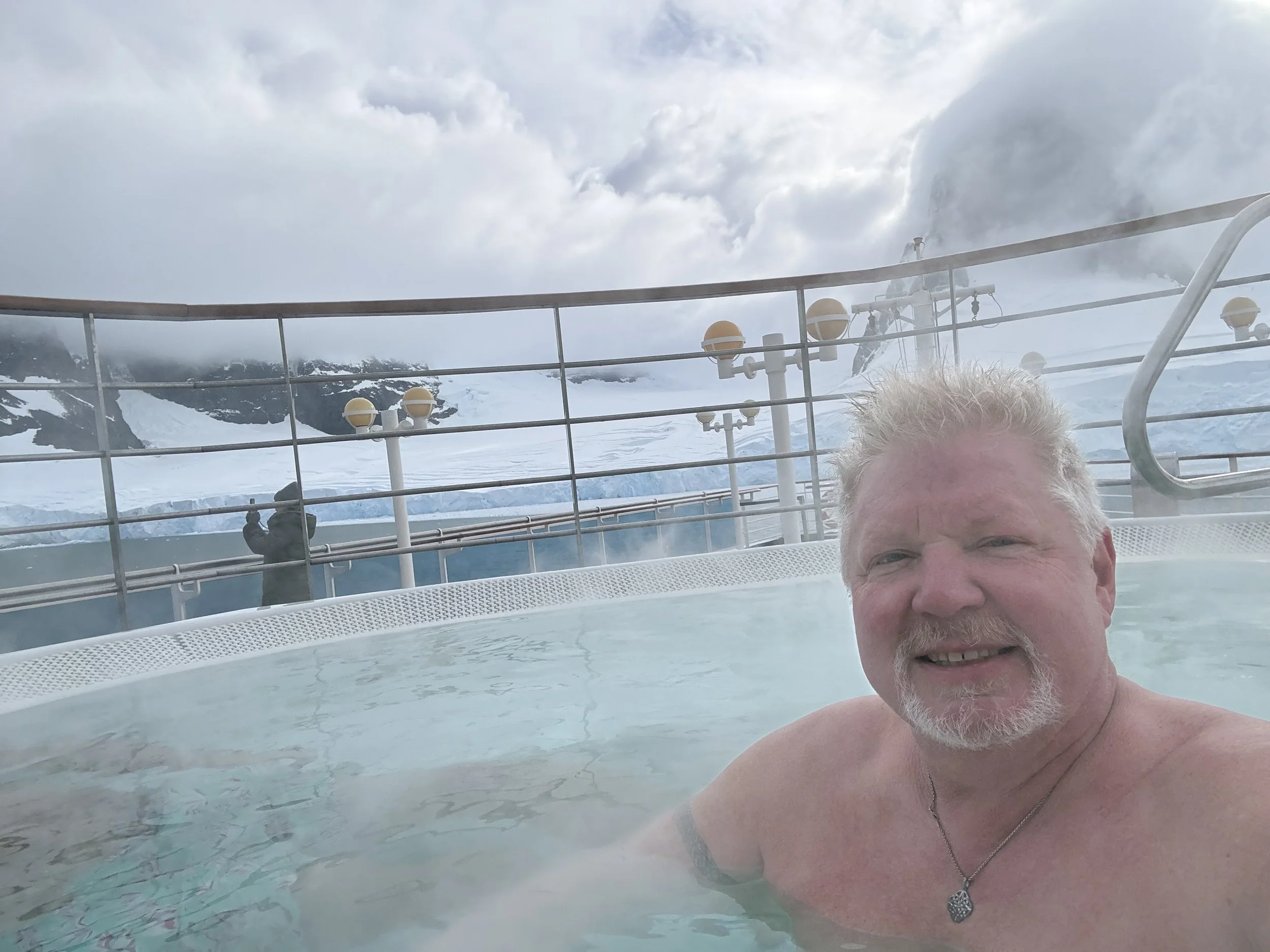
Morning Hot tubbing!
The weather was perfect. The skys cleared and we got some amazing views!
Peltier Channel & Neumayer Channel
Neko Harbor & Wilhelmina Bay
Neko Harbor was alive with wildlife!
Penguins on an iceberg
Humpback whale!
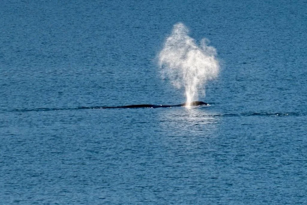
Whale spouting
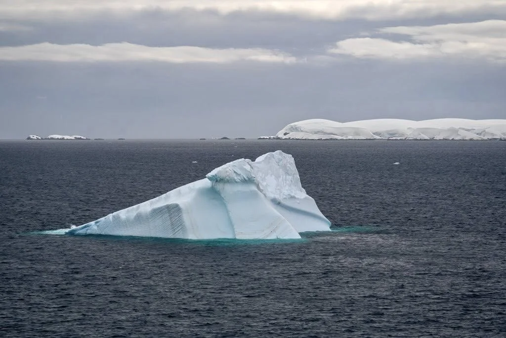
After spending time in Neko Harbour, we headed to Wilhelmina Bay. This seemed to be the birthplace of icebergs. So many icebergs. All types! There are names for each type. The smallest ones are called Growlers. There are chuck of ice three feet or smaller. Then there are Bergy Bits, these are about the size of a Volkswagon bug. Then you get into the larger ones. These will have names based on shape as well (Tabular for rectangle ,….)
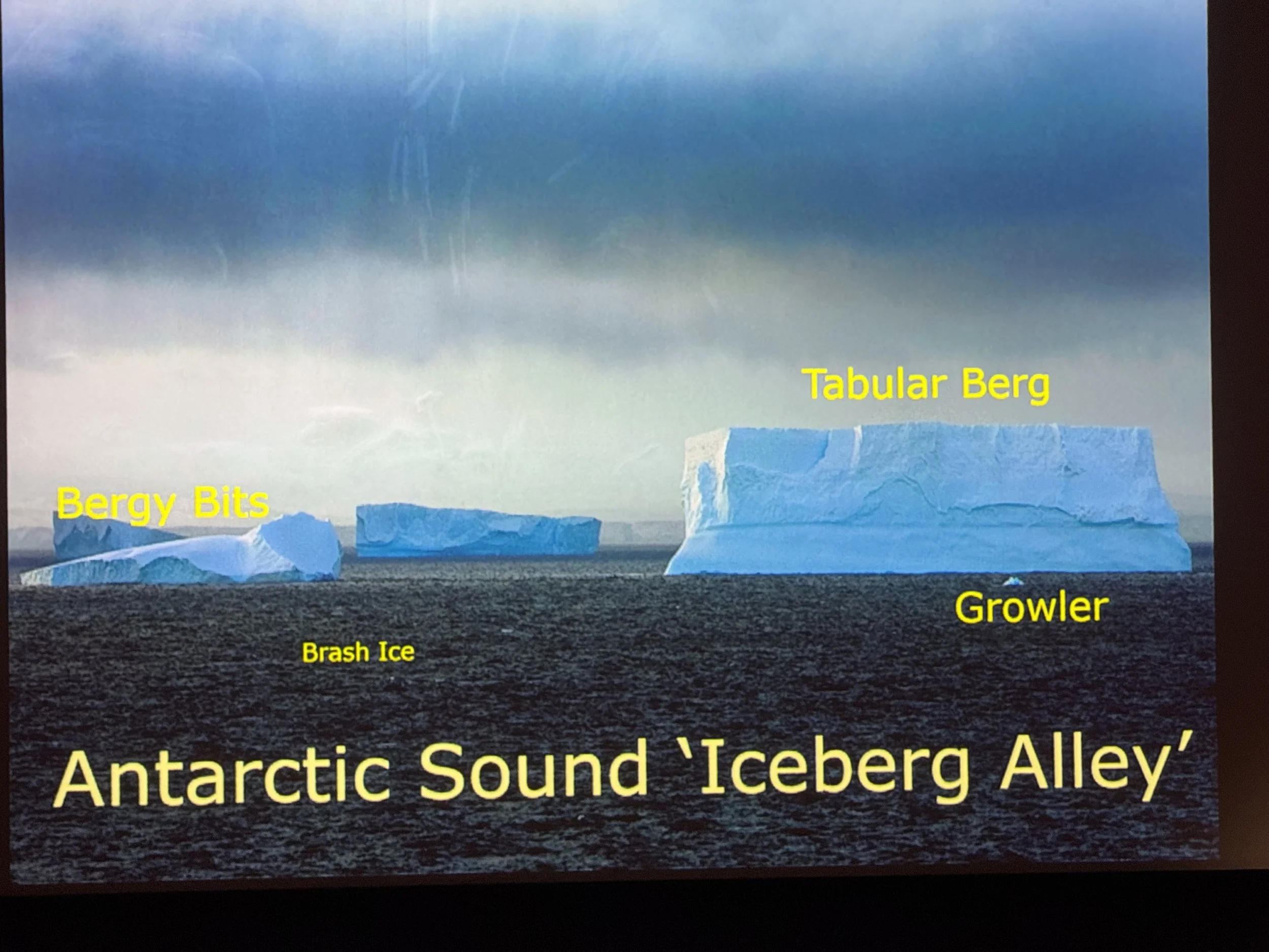
From our presentation on Icebergs on the ship.
There are also two basic types of Icebergs as well. Land Ice is harder and can easily cut through metal hulls. Sea Ice is frozen sea water and is softer. Our ship has bubble blowers that will punch the ice wash from the ship as it moves forward.
Wilhelmina Bay is also known as Whale Mania Bay. There is a large amount of krill in this area, so it is a feeding ground for many whales.
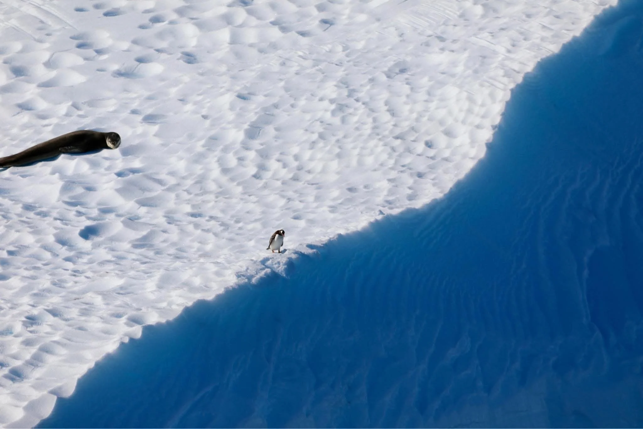
A passing iceberg had both a fur seal and penguin.
It was an another formal night on the ship. We got dressed up and had a great dinner.
Then we went up to the Skywalker Lounge to more viewing. It never gets old!
The days are longer here. In fact it never gets dark. At 10:00pm we decided to continue our viewing on the hot tub. This is the best way to view (especially with a nice cocktail in your hand)
Day 3 (February 4th)
Today we got up early (6:00am) to see Deception Island. We are expecting to see lots of penguins and seals. We were not disappointed. The naturalist said that there are over 50,000 pairs of penguins here. Based on what I saw. They are correct!
Deception Island is a collapsed (but still active) volcanic cone. There is a 12km wide natural harbor, one of the safest in the world protected by high cliffs and a narrow entrance, Neptune's Bellows. It was first used by sealers as a base for operations and then later by whalers. Our ship was too big to go through Neptunes Bellows, but we got a good view looking into Port Foster bay.
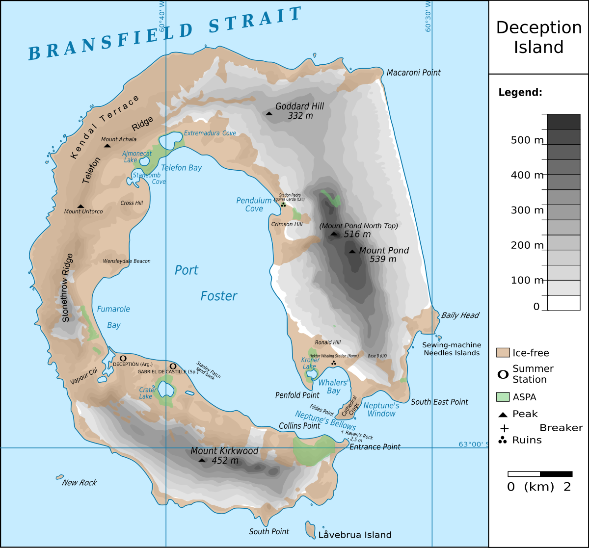
Map of Deception Island.
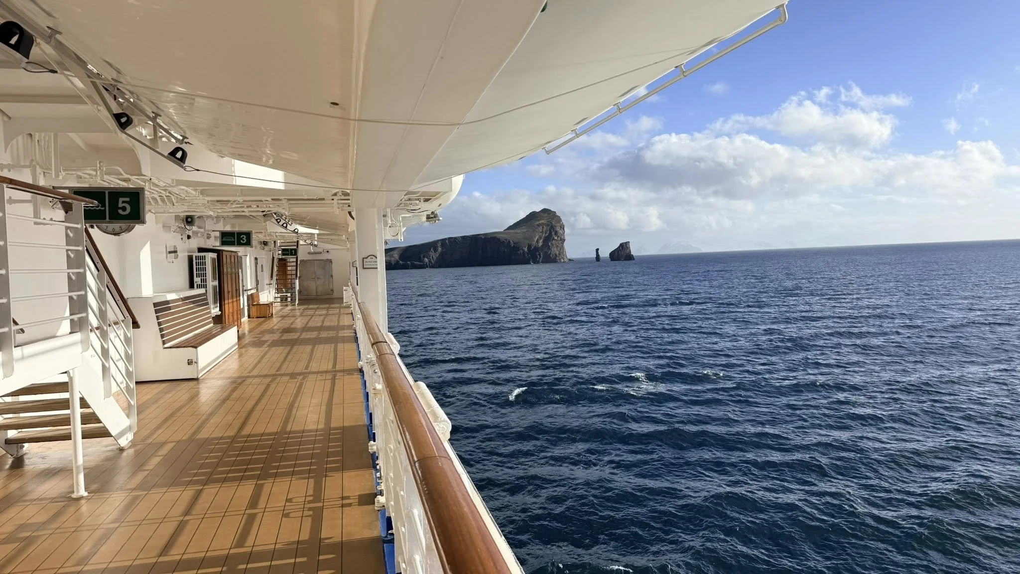
View of Sewing-Machine Needles at Deception Island. The name Sewing-Machine Rock was given by whalers for what was originally a conspicuous natural arch.
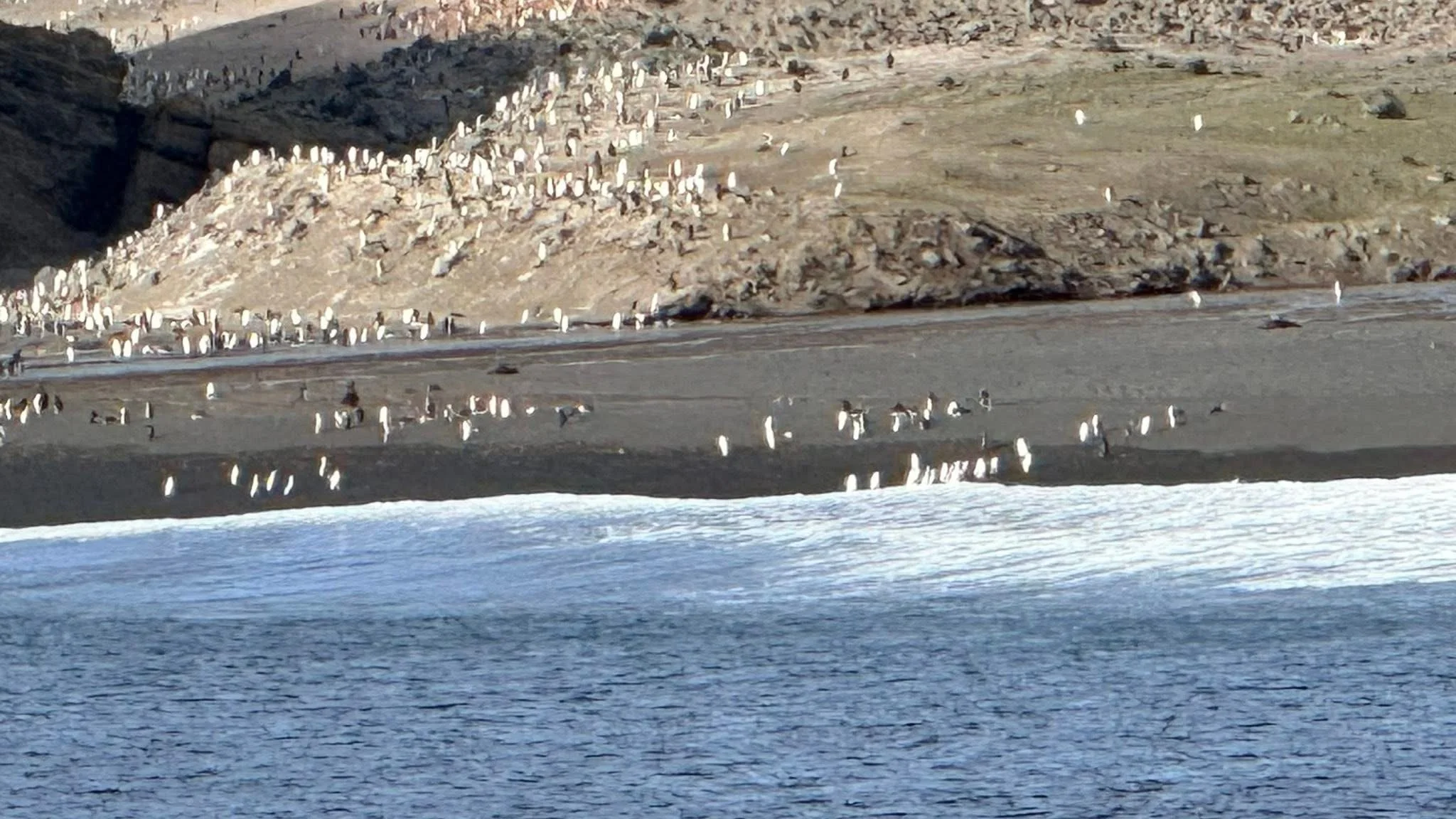
Deception Island. The white dots are penguins, the brown “logs” are fur seals.
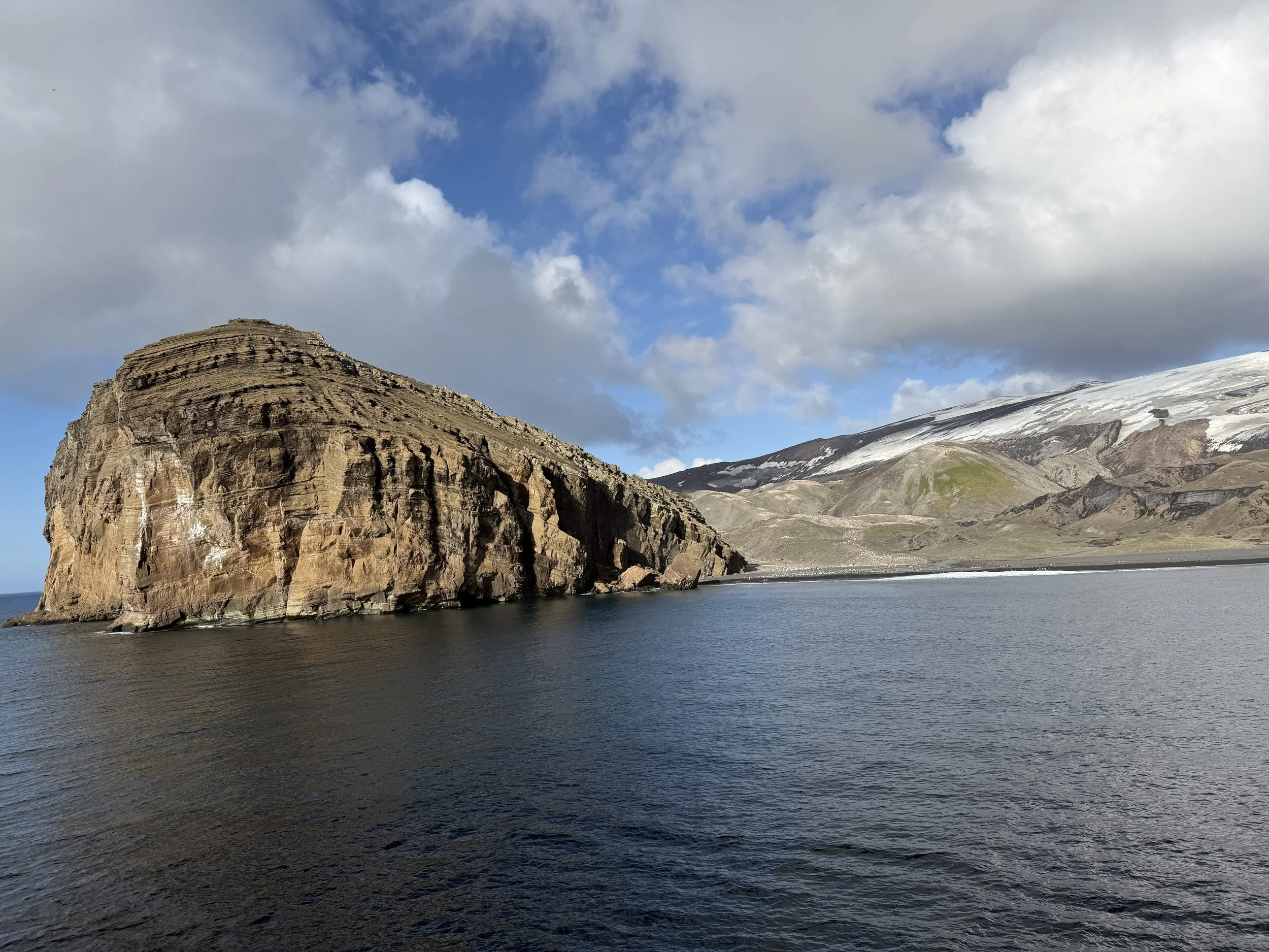
Shore view of Deception Island.
View of east side of Deception Island as we left.
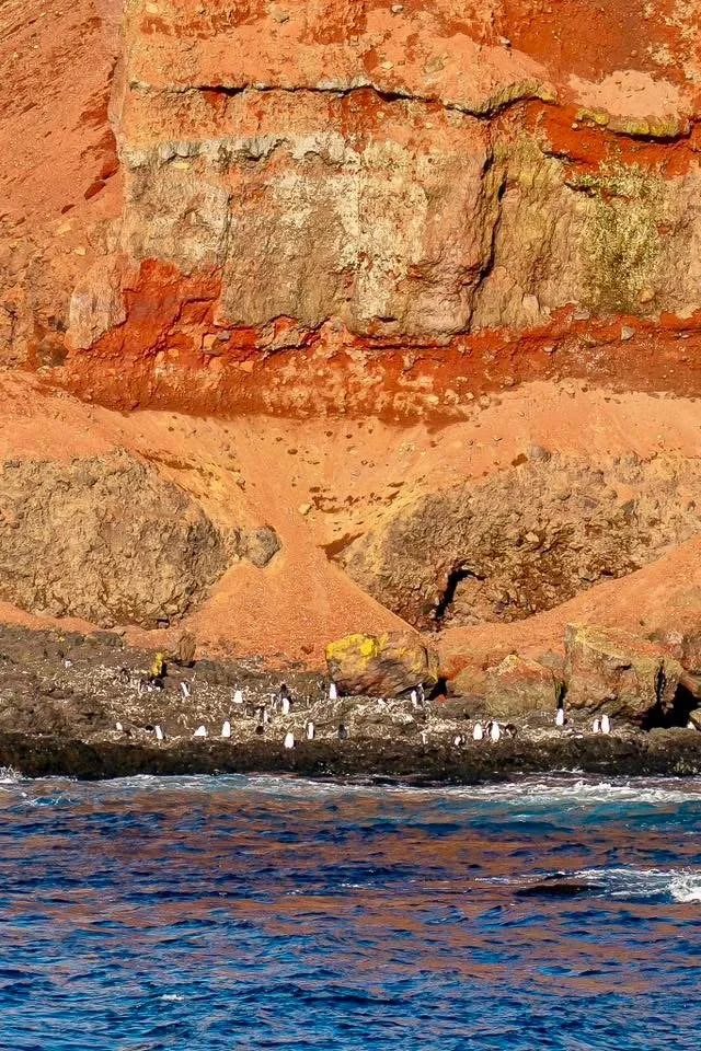
Penguins with the red ash from previous volcanic eruptions.
Penguins.
Deception Island is an active, horseshoe-shaped volcano in the South Shetland Islands, near the Antarctic Peninsula, known for its flooded caldera that forms a sheltered harbor, Port Foster, accessible through a narrow entrance called Neptune's Bellows. It's a popular destination for its unique volcanic landscape, steaming beaches, penguin colonies (like Chinstrap), and the ruins of past whaling and sealing stations, though it remains seismically active and is monitored for eruptions.
Admiralty Bay
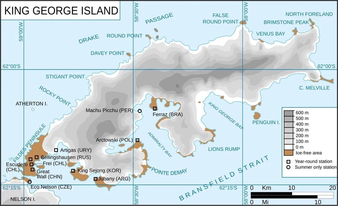
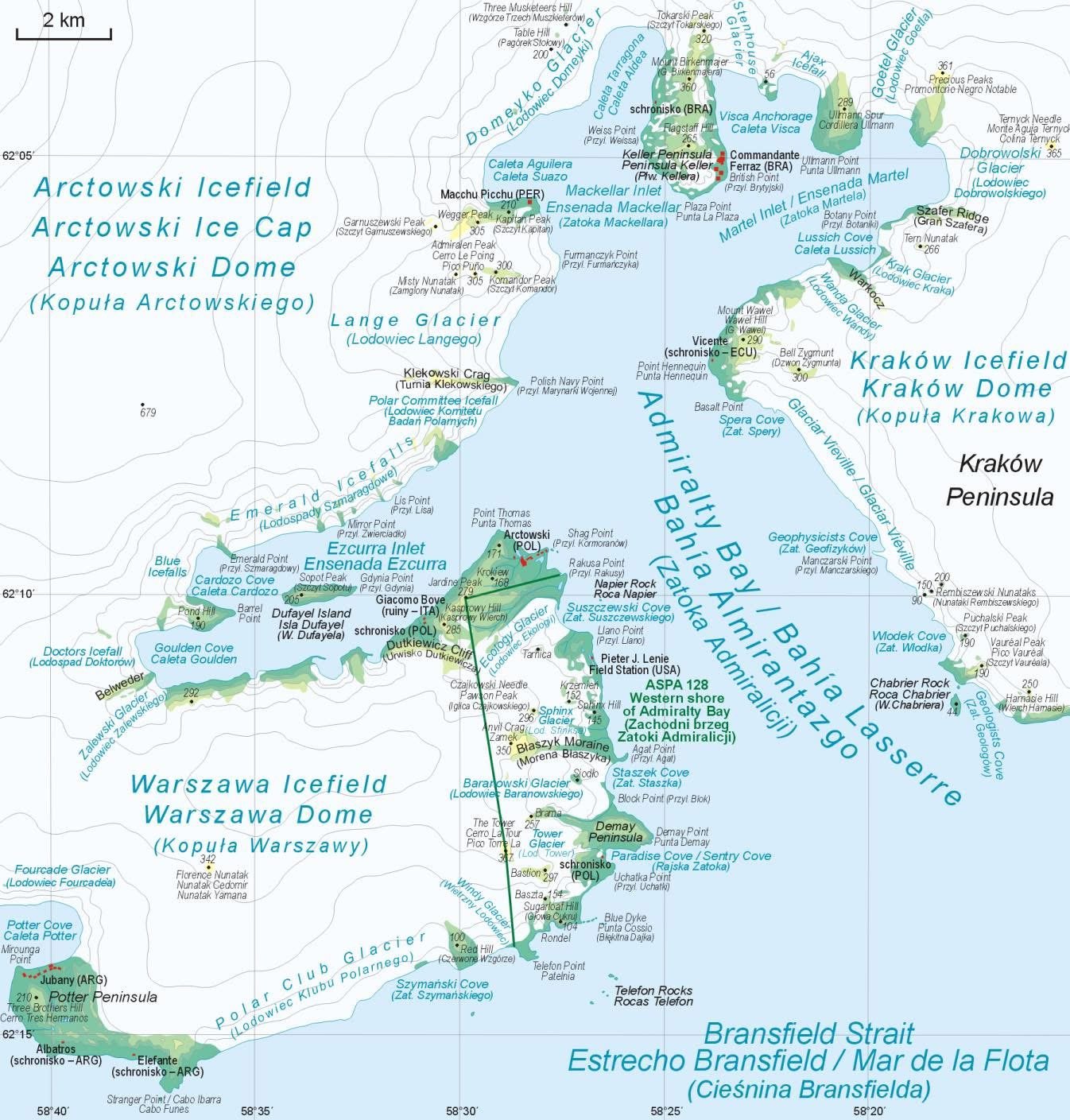
Admiralty Bay is part of King George Island. King George Island is the largest of the South Shetland Islands, lying 120 km (75 miles) off the coast of Antarctica. The island was named after King George III.
There are five research stations located here. USA, Poland, Peru, Ecuador, and Brazil.
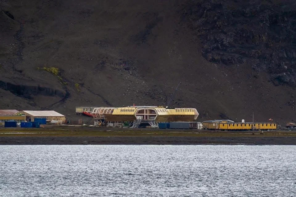
Polish Research Station
We saw a few whales and penguins here, but mostly glaciers coming into the bay from all sides.
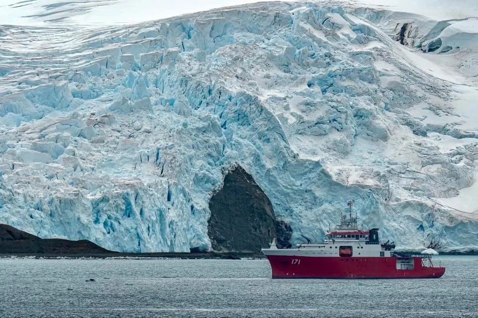
Research vessel (they are all painted red for safety)
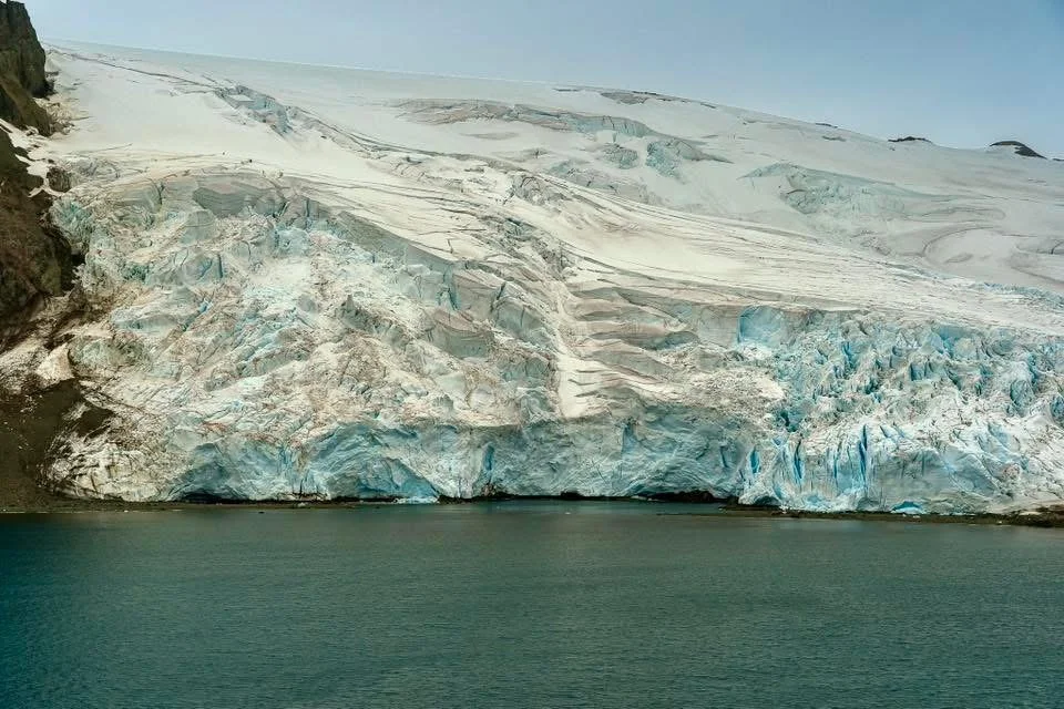
Emerald Falls Glacier
10:00pm at night as we leave King George Island. Yep, it does not get very dark here!
Day 4 (Februrary 5th)
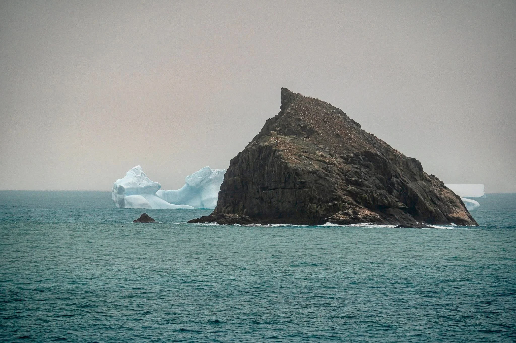
Elephant Island
We arrived at Elephant Island early in the morning (6:00am). This island is named by the seal hunters that came here first. This island is inhabited by elephant seals, hence the name.
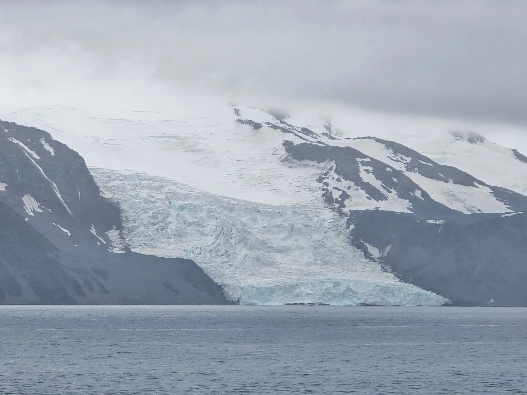
The seas are calm, but the skys are cloudy. We are not able to see the tops of the mountains on the island. But there are many glaciers coming into the sea.
To protect the marine life here, this is a geofenced area. This means that ships are limited on routes and speed. They must not exceed 10 knots/hr.
This is the area where the chin-strap penguins nest. There are about 25,000 pairs nesting here. The numbers on these penguins are in a decline.
Point Wild
It was named for Frank Wild, leader of the party from Shackleton’s Endurance shipwrecked expedition. Only one small boat survived the shipwreck. Shackleton and 5 crew members set out to find help. 22 crew members stayed behind and managed to survive on the point for four and a half months until they were rescued on 30 August 1916 by the Chilean Naval vessel Yelcho commanded by Captain Luis Alberto Pardo. They survived by eating penguins. A bust of Captain Pardo has been placed at this point to commemorate the rescue.
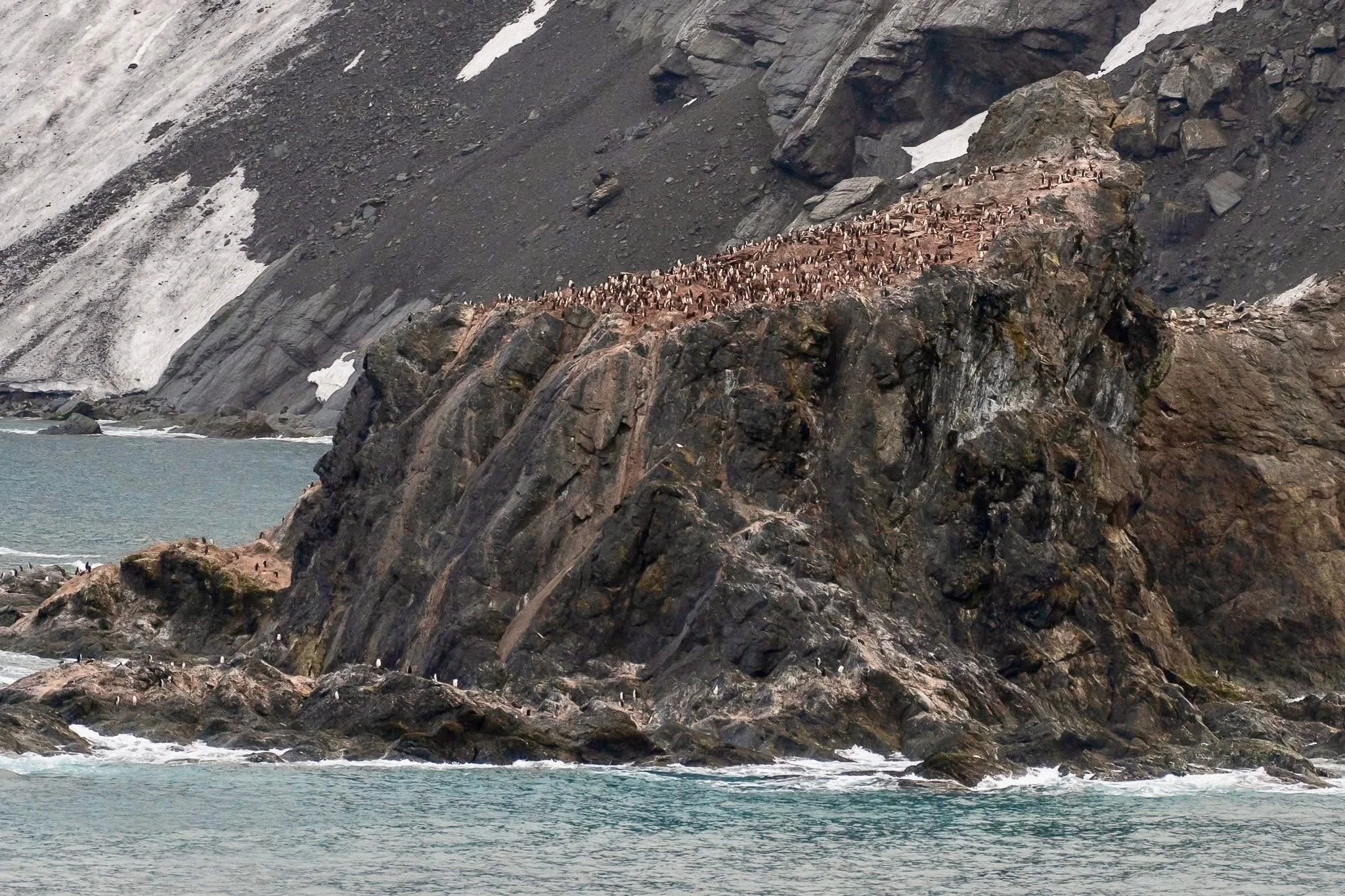
Chinstrap penguin colony. (Very smelly!)
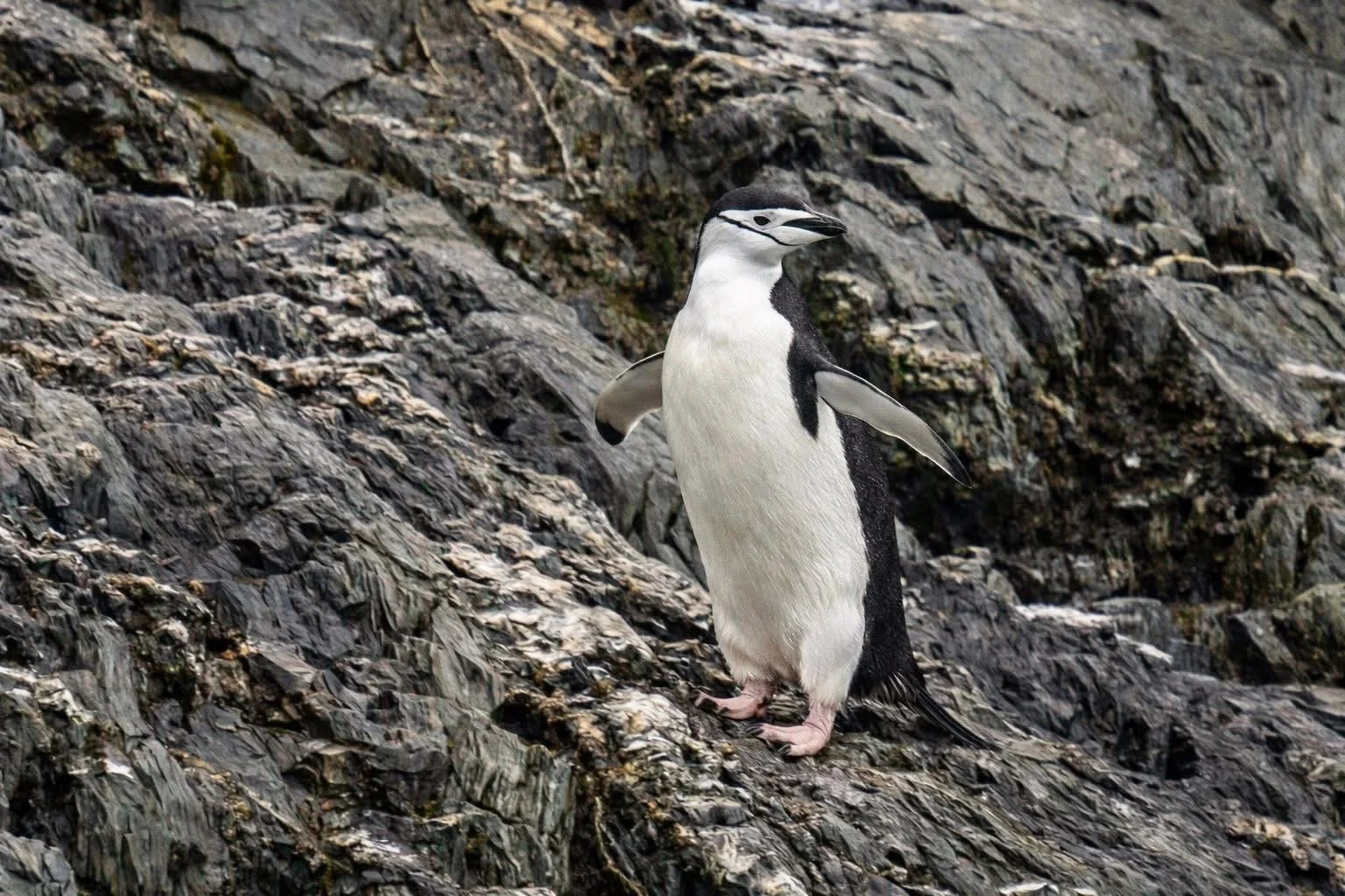
Chinstrap penguin
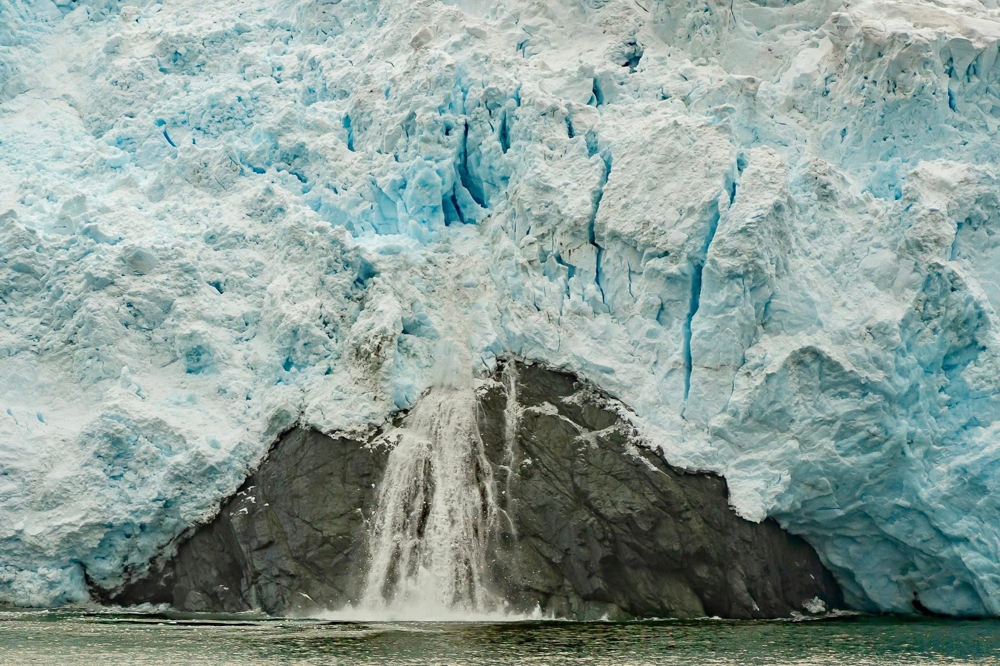
Glacier calving.
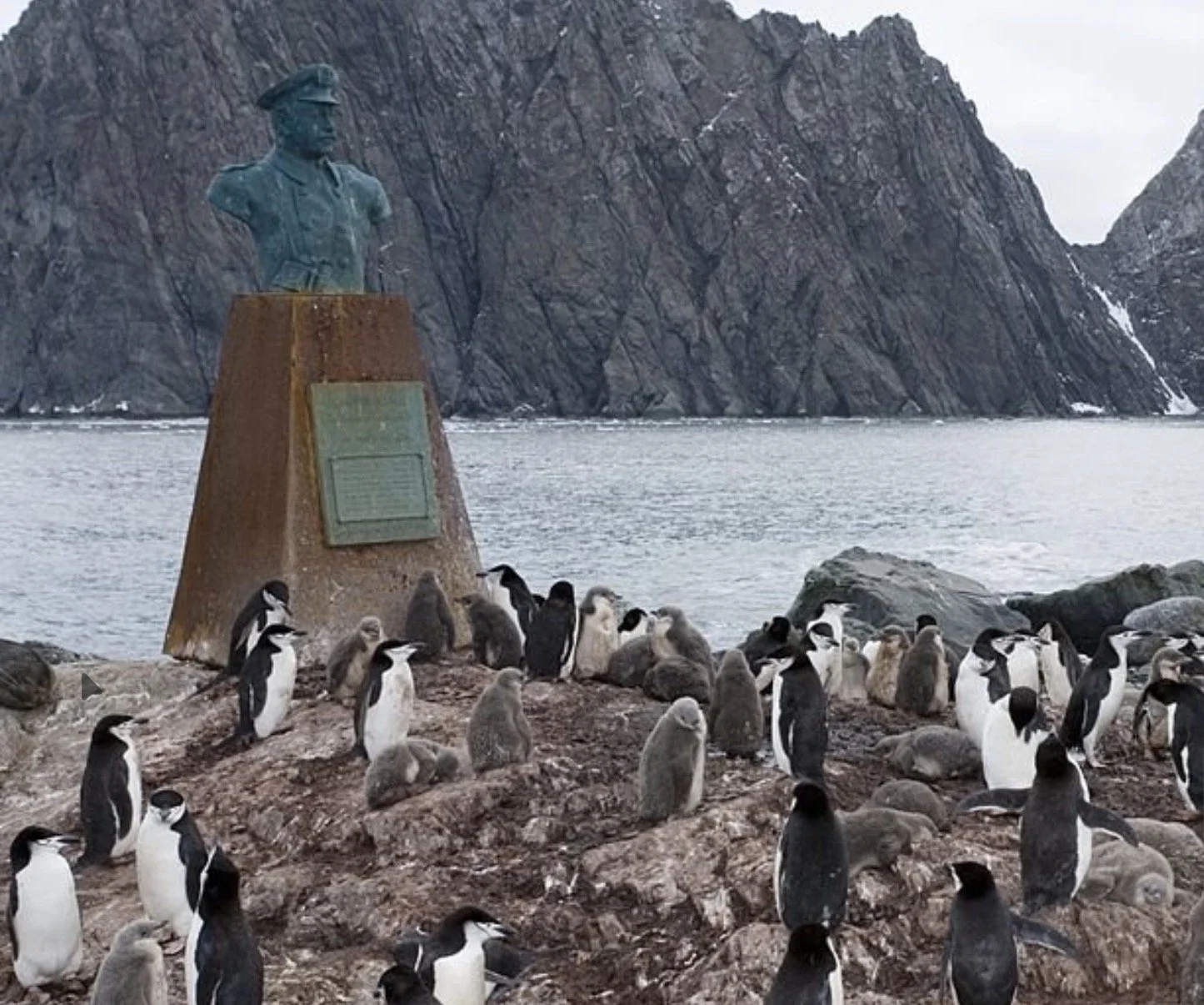
Captain Pardo bust where the Shackleton 22 were rescued .
We left Elephant Island around 1:00 and started heading towards Port Stanley in the Falkland Islands. The weather has become foggy, so it will be along journey. We will be arriving there in two days.
Below sums up how I am feeling about this trip. (From a fellow passenger)
Tonight was cross Drake Passage again to get back. It is forecasted to be “Drake Lake” with a little of “Drake Shake” tomorrow morning. I will let you know.